

The final day of the classic Walls of Jerusalem Circuit, this section of the walk takes hikers off-track through Jaffa Vale to Lake Ball Hut. Following the lake shore, the track descends to Lake Adelaide before following the Junction Lake Track back to Trappers Hut past a series of smaller lakes and tarns. Featuring stunning displays of the turning of the fagus in Autumn, this is a great way to complete a visit to this spectacular park
Distance: 16.4 km
Gradient: Largely gentle gradients with some short, mildly steep sections including a steep descent to Lake Adelaide
Quality of Path: Non-existent our a rough bushwalking pad from Dixons Kingdom to Lake Ball, then a rough but largely distinct trail to Trappers Hut. Some goat trails and lack of clarity at times.
Quality of Signage: Largely well signed with good orange track markers/pegs, however junctions are not clearly marked
Experience Required: Previous Bushwalking Experience Required
Time: 6.5 hours, including lunch
Steps: Many steps, both formal and informal
Best Time to Visit: Spring-Autumn
Entry Fee: Yes. National Park Fees apply
Getting There: No direct access to Dixons Kingdom. Walkers are required to walk in from the Lake Rowallan car park as outlined in Day 1 of the walk. Entry Fee: Yes. National Park Fees apply

After a fairly short but spectacular day tackling the side trips to Mt Jerusalem and Solomons Throne, Alissa and I had a better (but still broken) sleep at our new tent site, and woke up to a glorious sunrise in Dixons Kingdom. With literally not a cloud in the sky, the Kingdom was an inviting place to stay and linger for a while, but with a fair few kilometres on rougher tracks to cover and a bus waiting to pick us up at 3pm we did our best to have a quick breakfast, pack up and be on our way.

While the open-ended nature of the Walls means it can be walked a number of ways, Alissa and I opted to follow the classic circuit which follows an alternate route from Dixons Kingdom back to Trappers Hut via Lake Ball and Lake Adelaide. In spite of this being a well known itinerary in an area considered one of Tasmania's Great Multiday Bushwalks, it is surprising to note that the first stretch from Dixons Kingdom to the shores of Lake Ball does not feature a trail at all, with walkers having to follow an unmarked route down Jaffa Vale.

This route is fairly easy to follow for the most part - basically stay close to the Pencil Pines, don't head too far to the left and keep following the vale downhill to the lake. The popularity of the circuit became rather apparent as a fairly distinct bushwalking pad can be followed for most of the way, though there are sections where it becomes a bit of a multiple choice maze.

Whenever we lost the track, we would simply follow water courses as we knew they would be emptying into Lake Ball, and it would only be a matter of time before we were once again walking along an easy to follow pad.

While Alissa and I spend the majority of our hiking time on formed track walks, we did enjoy the route finding along this stretch, and there were times when both of us found the route when the other had missed it. At one point early on I thought we should go in the forests while Alissa thought it was better to stick to the open plains, and Alissa ended up being correct. Later on, my instinct was to head into the forest, and we discovered a well worn pad passing through a lovely stretch through the trees.

Heading through the forest, Alissa made the first of many major stream crossings for the day, however our boots were already well and truly soaked from having walked up the soggy, grassy Jaffa Vale. Dry boot walkers would not like this day.

Heading through the forest, the rough track led us to a forest clearing that revealed that we were close to the shores of Lake Ball. At this point the pad became indistinct and difficult to find, and it was pretty obvious that walkers have gone in many directions at this point without following a consistent route. Having studied the map, Alissa and I knew that walking straight to the lake shore would take us into fairly swampy territory and that we had to instead swing right to find the start of the constructed track that runs along the shores of Lake Ball.

This was a bit of a bush bash as we made our way up the vale through typically scratchy Australian forest. We knew which direction we needed to head to and we just had to trust our intuition to work out which way to go to get to the track.

At one point, I looked down on the lake and was pretty sure that we should have hit the track by now, and I figured we must simply be too high to be on the track. Sure enough - after descending slightly, Alissa and I were back on a formed and marked track. While this off track route was fairly easy to follow, from here on out we could largely keep navigation on autopilot as we followed the track and orange markers back to Trappers Hut.

As we continued along, Alissa and I were literally stopped in our tracks but something we were extremely excited to see - the turning of the fagus! The Deciduous Beech, a relic from Gondwana and found only in Tasmania, is one of Australia's only native deciduous trees. While it may not be as spectacular as seeing the New England region of the US in the fall, seeing native autumn leaves in a scene of pure Australian wilderness was a real treat that made us love Tasmania even more.

The downside of Deciduous Beech is that it also lives up to its other name - Tanglefoot. There were a lot of exposed roots all over the track, however this was nowhere near as bad as some sections we had encountered on the Overland Track.

And besides - walking through the falling leaves was such a joy that we were not in a real rush at this point.

A third of the way along Lake Ball, Alissa and I reached Lake Ball But - the third vernacular wooden hut we had encountered along the circuit.

Similar in style to Trappers Hut but to a better standard, Lake Ball Hut was built by Boy Miles, who was something of a local legend due to being an accomplished bushman who had a hand in constructing a number of the huts in the area, including the original Trappers Hut and the original Windy Ridge Hut on the Overland Track before it was replaced by the state of the art Bert Nichols. An information panel in the hut explains that as a World War II veteran and a survivor of Japanese prisoner-of-war camps, Boy Miles found solace and healing in the mountains. It was quite a touching read, and while those who knew him are probably few and far between now, it is nice to know that the legend of Boy Miles is still commemorated on the shores of Lake Ball.

Beyond Lake Ball Hut, the track heads through a particularly rugged section of Dolerite boulders. Given all the recent snow, the rocks were a bit slippery, however Alissa and I were grateful that this was at least not a much more slippery rock like granite.

The track remains fairly high above the lake as it follows a ridge for most of the middle third. This was one of the best parts heading along Lake Ball as it provided a perfect vantage point from which to view the fagus in action as we looked down onto the glass lake below.

It was interesting to see a sharp contrast between the mix of Pencil Pine and Deciduous Beech growing on our side of the lake, while the other side was almost entirely dryer Eucalypt forest.

As we got closer to the end of Lake Ball, the forest type turned into a transitional mix of Pencil Pines and Eucalypts. A clearing with small tarns and a creek made a pretty scene along this transition zone.

The creek crossing through the clearing was surprisingly deep; we estimated it was have been at least waist deep at its deepest point, however a stepping stone submerged just beneath the water meant we only had to get our feet wet as we made our way across.

From the clearing, the track begins to descend, and Alissa and I were amazed to see that it actually went right into the waters of Lake Ball! Once in the water, the track completely disappeared and Alissa and I were convinced we had taken a wrong turn. Seeing a rocky lookout point above us, we scrambled up the steep slope thinking it was a track, however this proved to be a false lead. The high viewpoint did however give us an indication of where we needed to get to as we could see the track continuing further along in the valley between Lake Ball and Lake Adelaide. As we climbed down from the lookout point, Alissa and I ran into the two Dutch hikers I had summited Solomons Throne with the previous day, and they confirmed that they had walked straight through the water and rediscovered the track on the other side.

The mildly waterlogged and muddy track runs through a swampy vale. The track through this section runs right alongside several Cushion Plants. Highly fragile plants that take a long time to recover from being stepped on, Alissa and I watched our footing throughout this section to avoid damaging these beautiful alpine plants.

Having already committed to getting our boots wet, Alissa and I were unfazed by having to crossing a broad but shallow stream. We agreed that the water was actually quite refreshing, and it provided an opportunity to wash some of the mud off from the swamp walking. The Dutch hikers were not as keen and looked to cross via a fallen tree, and we were soon some distance away from them.

After crossing the broad creek, Alissa and I found ourselves in an area that looked a lot like the Perth Hills due to the prevalence of dry Eucalypt forest, a scratchy understorey and grey Dolerite that could easily have stood in for the Granite that dominates the hills.

This dry Eucalypt section was a surprisingly steep walk as it had us rapidly descending through the forest to Lake Adelaide. Although we had seen the contour lines on the map, it hadn't really dawned on us just how much lower Lake Adelaide is compared to Lake Ball.

Clearing the forest, Alissa and I reached the northern tip of Lake Adelaide as the Lake Ball Track joined onto the Junction Lake Track. Taking the Junction Lake Track to the left leads through Walls of Jerusalem National Park towards Lake Meston and Junction Lake, with Lake Meston Hut being a potential side trip we would have headed for if all the side trips in the Walls had been inaccessible due to heavy snowfall. Following the Junction Lake Track to Junction Lake itself, it is possible to cross over through the Never Never and the Mersey River and reach the Overland Track. This exciting optional trip would have to wait for another time however, as we would instead be taking a right turn onto the Junction Lake Track and heading back to complete the loop to Trappers Hut.

Near the shores of Lake Adelaide is a designated camping area under the Pencil Pines. While lacking in facilities, the area makes for a lovely and inviting campsite.

Lake Adelaide in nearly 100 metres lower than Lake Ball, and that difference in elevation made for very different vegetation along this next stretch of track. Heading north from Lake Adelaide, the track passes through a swampy valley of constant puddles, tarns and small lakes. With the prevalence of taller grasses and a dryer appearance, this part of the walk reminded Alissa and I of the Pingerup Plains on the Bibbulmun Track in Western Australia - a section of track famous for its flatness, tall grasses and annual inundation.


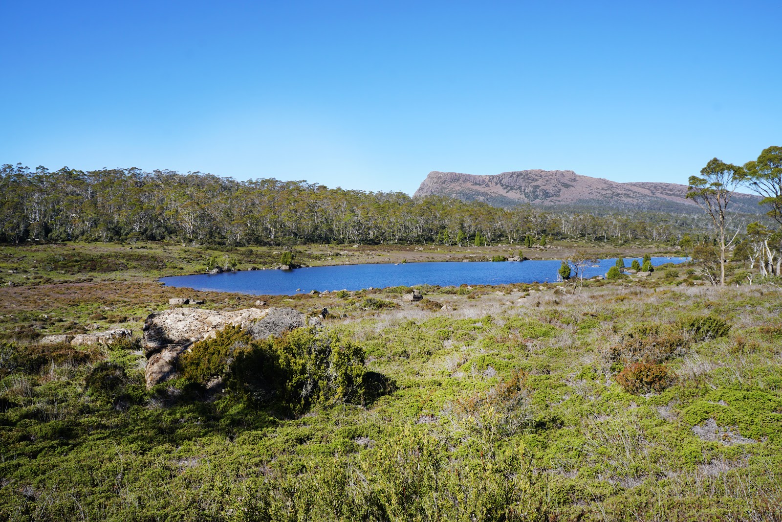
Due to the distinctive shape and size of the larger lakes, Alissa and I were able to use them as checkpoint markers to give us some indication of progress. The unnamed lake pictured above let us know we were a quarter of the way along from Lake Adelaide to Trappers, which meant we were making good time.

While confident of making it to the car park in time for our pickup, we were conscious of not getting too complacent; a lot of the track was flooded and/or muddy, so it was still very mentally active walking that required a bit more concentration than a well formed, dry boot path.

Just above a small waterfall, the track crosses yet another stream. At this point there were a number of goat tracks heading in all kinds of directions, however the appearance of a marker on the other side of the creek helped us find the correct path.

Looking to the east, it was interesting to see the mountains of the Inner Walls from the other side. Where the West Wall is a sheer cliff within the Inner Walls, the mountains have a more gradual slope when seen from the Junction Lake Track.

Our next major landmark was Stretcher Lake, which was visible to the left of the track. Stretcher Lake was probably one of the most distinctive lakes north of Lake Adelaide as the reeds growing throughout its waters gave it a golden glow on this very sunny day.

Looking westwards, we could see Barn Bluff and Cradle Mountain. Both mountains had largely lost the dusting of snow that had been visible on our first day on the track, and it made us feel very fortunate to have walked into the Walls on the day that we did.

Continuing along, Alissa and I could see King Davids Peak as we reached another creek crossing. This was another waist deep crossing that required us to think about foot placement; by stepping on a stone beneath the water we only had to get wet to our knees.

After walking through an area bereft of more obvious landmarks, Alissa and I were relieved to find ourselves along the banks of Lake Loane - the last of the distinctive small lakes along the Junction Lake Track before it swings north-east towards Trappers Hut. At this point we ran into a family we had met on our first night at Dixons Kingdom. The family had walked through Jaffa Vale the previous day and camped at Lake Adelaide. Alissa and I agreed that this would be a sensible four day itinerary if doing the walk with children as it would break up this longer day along rougher tracks into two more manageable portions for children to tackle.
As we reached the north-western corner of Lake Loane, Alissa and I had one final glance back at King Davids Peak as we bid farewell to the beautiful mountains of the Walls of Jerusalem.

From Lake Loane, a change in vegetation indicated to us that we were getting close to Trappers Hut, as the area started to take on the appearance of the forests we had encountered on our first day approaching Solomons Jewels.

After passing the stony remnants of what looked like an old hut, Alissa and I found ourselves in what looked like a manicured garden of low grass.

We had seen this garden from the track on our first day just beneath the track junction, and after rising up a series of well constructed steps, Alissa and I were back at the sign having successfully completed the Walls of Jerusalem Circuit.

From there it was a short 500 metres downhill to Trappers Hut. Having arrived ahead of schedule, Alissa and I stopped for lunch and a cup of tea by the hut. The family by the lake and the Dutch duo caught up to us around the same time, however neither stopped at Trappers as they were keen to get going to their cars below.

After packing our gear up, Alissa and I began the steep descent to the car park. Alissa and I had forgotten how rocky the path had been, with the steepness being even more noticeable on our way down that it had been on the way up.

After signing out at the walker registration shelter, Alissa and I met up with our ride at the car park. The Dutch duo were still in the car park and we wished them luck for the next part of their adventures as they were heading towards Cradle Mountain to tackle some of the day walks.
This third day of the Walls of Jerusalem Circuit was easily the most difficult day of walking, largely due to the off-track nature of the section between Dixons Kingdom and Lake Ball, and the fact that the Junction Lake Track is built to much rougher and less tourist-friendly standard than the Inner Walls. While this day lacked awe-inspiring mountain summits, the lakes along the way had their own beauty, with the turning of the fagus along Lake Ball being a major highlight of the entire three day trip. While the wet boot nature of this third day will not be for everybody, Alissa and I enjoyed having alternate scenery and the more adventurous nature of the walking, and we would recommend it as a great way to enjoy a different side to the Walls of Jerusalem National Park.


0 comments:
Post a Comment