
The centerpiece trail of Mt Lindesay National Park, this 10 km return walk to the summit explores the easternmost expanse of the Walpole Wilderness. Beginning as an easy walk through Jarrah forests, the trail's incline increases up steep granite slopes surrounded by biodiverse heathlands and impressive rock formations. With its gradual increase in difficulty, this is an ideal trail for intermediate walkers moving to more challenging terrain.
Distance: 10 km (return)
Gradient: Begins as a fairly easy walk with a gentle ascending gradient, but increases in difficulty as the trail ascend several steep and potentially slippery granite slopes.
Quality of Path: Generally clear and straightforward, with some potentially confusing sections over the granite slopes. The loop at the top seems to be overgrown as is now simply two spurs.
Quality of Signage: Good and very informative trailhead. Limited signage along most of the straightforward sections, with pegs and arrow markers along the granite slopes making the path fairly clear.
Experience Required: Previous Bushwalking Experience Recommended. This would be a good walk for walkers looking to push beyond easy walks to something more difficult. People with known knee problems may not be able to complete the harder sections
Time: 3.5 Hours
Steps: Many steps earlier on.
Best Time to Visit: Autumn and Spring, and milder Winter days. Spring would be particularly perfect due to the abundance of flowering species.
Entry Fee: No
Entry Fee: No
Getting There: Mt Lindesay's trailhead can be reached via Scotsdale Rd, with the turn off to Mt Lindesay Rd heading north-east. The turn off for the trailhead's car park is well signed.

In spite of being the closest major day walk to the town of Denmark and being featured in the then DEC's publication Bushwalks in the South-West, the Mt Lindesay Walk Trail is one of the more obscure trails in the area. There is a great dearth of photos and information online regarding this trail or the National Park it is within. In fact, some websites erroneously feature photographs of a taller, more rugged Mt Lindesay in Queensland or use photos of a smaller peak in the park as their feature photo (more on this later). Intrigued by this mystery, Alissa and I, along with her mother Jane, decided to investigate.

The drive from Alissa's parents' house in Denmark to the trailhead was relatively easy, and we were surprised to find the the trail's amenities to be of a high standard for a trail as little discussed as this is. The trailhead featured many large, informative panels, a picnic table and even a nearby toilet! The quality amenities continued with a purpose built bridge that crosses the Denmark River a short distance from the trailhead.

At this time of year (mid-Autumn), the river was still fairly low, though the narrowness of the river and the relatively low height of the bridge suggests the Denmark River never becomes the raging torrent of somewhere like the Frankland River.

From the river, the trail rises at a moderately steep gradient up a series of stairs. This climb is relatively short however, and the trail levels out to a very gentle ascent through pleasant Jarrah forest.
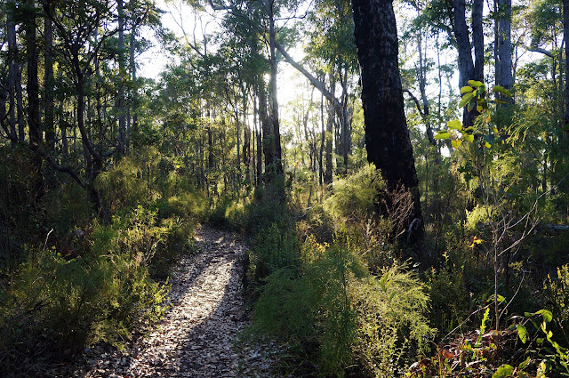
Superficially, the scrappiness of the Jarrah forest bears a resemblance to walking in the Darling Scarp, however the understorey plants are entirely different. Indeed, many of the plants in the National Park are rare and endemic to the region. Walkers familiar with the Karri and Tingle dominated areas of the Walpole Wilderness may find this forest less impressive due to its more stunted size, but the biodiversity on display reveals the park's importance as a conservation zone.


After a few pleasant kilometres in the forest, the trail heads into more open country, allowing for the first views of the rolling hills in the surrounding countryside.

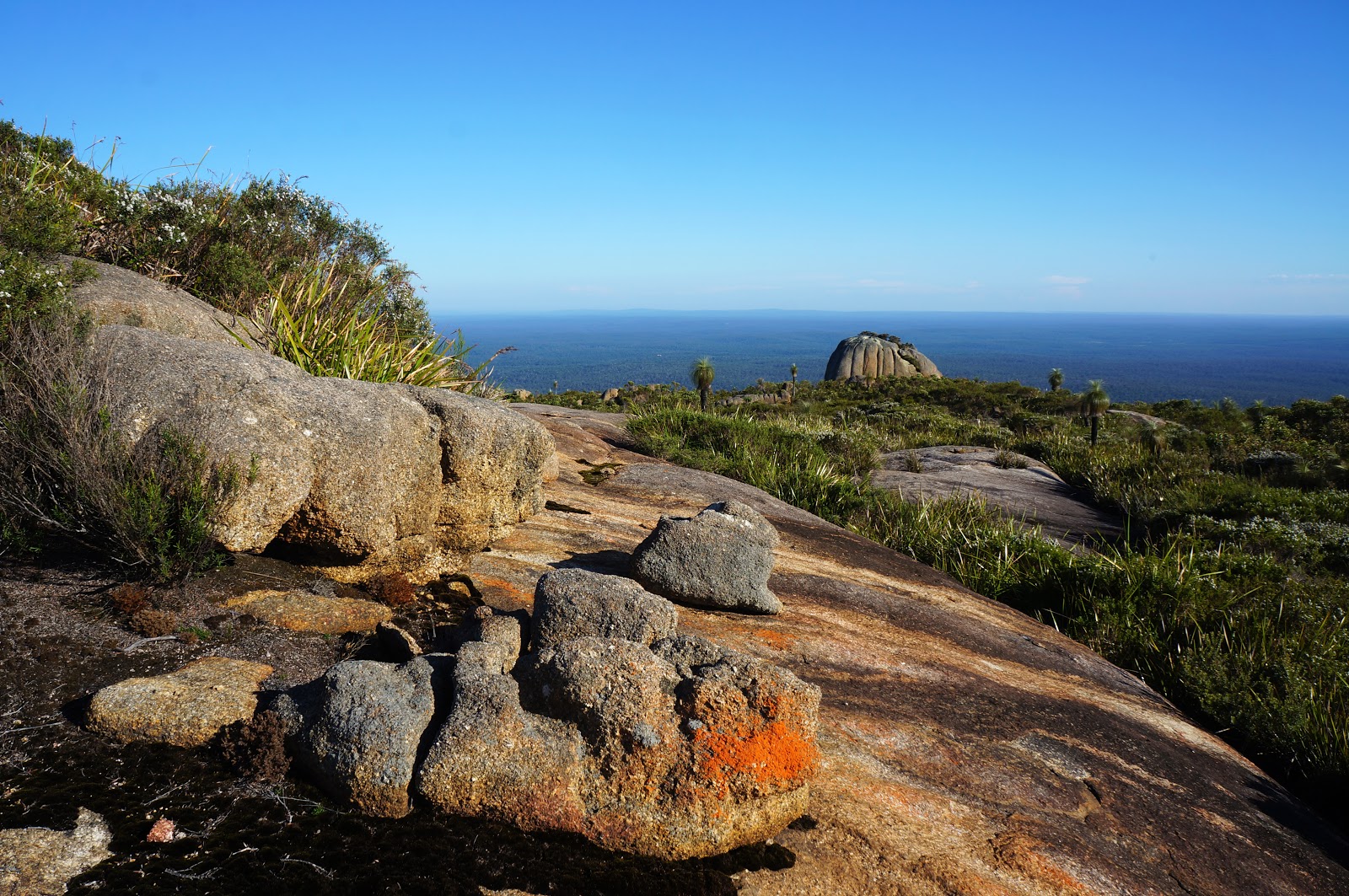
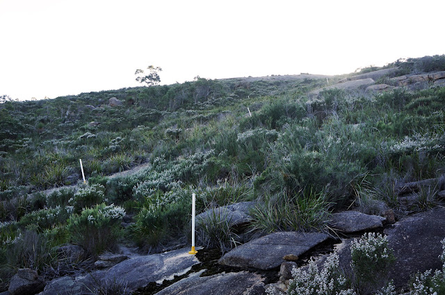
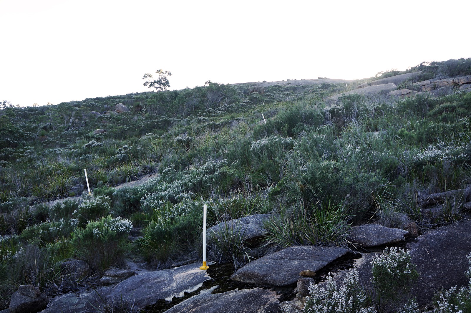
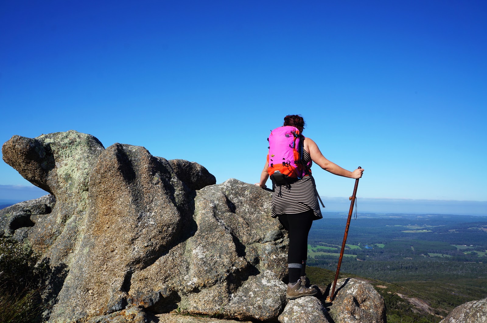
This more open area marks the beginning of more challenging walking, as the trail crosses many large granite slopes. Some of these slopes are very steep, but the roughness of the granite offers an easy gripping surface while plastic marker poles serve as excellent waymarkers.

The granite slope sections are probably my favourite parts of this trail, as they introduce some challenge to the walk without being overly difficult. Although these slopes are the reason that DPaW rate this as a Class 4 walk, they are considerably easier than the similarly rated Bald Head Walk Trail and make Mt Lindesay an excellent trail for intermediate walkers looking to transition to more difficult terrain.

Closer to the summit, the large granite slopes give way to heathlands. Many of these plants were recognisable to us as they can also be found on Alissa's parents' property, and many of them are spectacular in Springtime when their flowers are in bloom. As is often the case in Western Australia, this walk would be even better when undertaken at the height of wildflower season.

Nevertheless, there is always something in bloom, and even in Autumn we encountered a number of wildflowers along the trail.

Near the summit, the trail reaches a fork that is meant to be a loop. At the time of our walk, this loop was incomplete due to being overgrown, and is thus more like a number of spurs. The spur to the left leads to an interesting granite outcrop overlooking the countryside. To climb onto the outcrop requires either a short bush bash or climbing over some boulders as the trail seems to be heavily overgrown.

Interestingly, the outcrop shows signs of a structure having been built on it some time in the past, with some cement and brick remnants still in place. We thought that there may have been a lookout here in a time before wilderness values became more widely accepted park management practice.

Taking the trail to the right leads to the summit cairn, which is actually just a single granite boulder.

A plaque on the rock explains the historical importance of the site, as it was from here that Thomas Braithwood Wilson became the first European to site the Denmark Townsite in 1829, as well as the point from which many of the nearby rivers and mountains were named. Placed here in 1979, the plaque makes claims of discovery that are historically inaccurate but typical of the time, since the Aboriginal people in the area would have discovered all these places long before the colonial era.

Climbing on top of the cairn, Alissa found the seal of Lands and Surveys WA bolted on top of the rock.

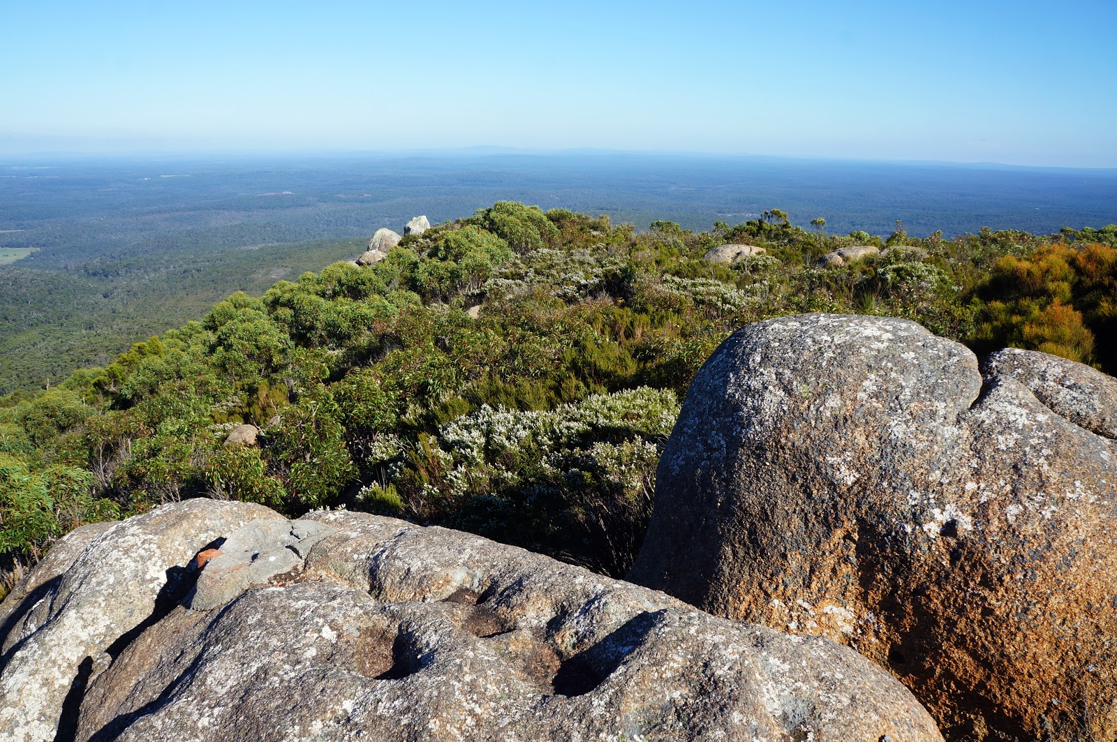
From the summit, the trail again branches in two directions. To the left, the trail leads to a dead end that presumably used to be part of the loop with the earlier spur to the left. Another trail from the summit appears to be an old vehicle track. We followed this track for a bit before realising it headed down the other side of Mt Lindesay and became increasingly rough. Along this section, we did see some very fine granite formations, including the landscape pictured above.

Additionally, as I stood on another granite boulder, Alissa and Jane called out to me to look up. Immediately above me was a Wedge Tailed Eagle soaring on the thermals, presumably investigating what I was doing in their territory. This photo does not do justice to how close the Eagle was to me, as I basically had to quickly shoot blind to photograph it. The Eagle flew further away and was joined by its mate shortly after, and we stood in awe at these majestic creatures in flight.

From there, we simply retraced our steps back for a relatively easy return walk to the trailhead.

Although we didn't see any of the marsupials that live in this area, Alissa did come across this neon yellow worm. Amazed by this strangely colourful creature, we thought it may have been a very young snake, however after searching online Alissa was able to ascertain that this was a terrestrial Planarian Worm - a type of carnivorous worm related to flatworms.
Overall, Mt Lindesay was a very enjoyable walk, and one that deserves to be better known. The changing scenery from Jarrah forests to granite slopes to heathlands makes this a varied walk, and the ramping up of difficulty over its decent distance makes it an excellent training ground for intermediate walkers looking to try out something with a bit more challenge. Given its heritage value, its proximity to Denmark and the abundance of wildflowers that would be in bloom in Springtime, it is perplexing why it has flown under the radar for so long.
The only disappointing thing for me was this:
I saw this video before we did this walk, and was excited by the landscape it depicted. As you can see from my photos, the heathlands-covered summit of Mt Lindesay is nothing like the large granite dome pictured above. We walked along the vehicle track hoping it led to this landscape, but gave up when we couldn't see anything that resembled the video's large expanse of granite. On our way back to the car, a sign advising walkers to be Dieback aware hinted at the answer - there is a second peak called Little Mt Lindesay. Sure enough; on closer inspection, the video does state in its description that it was filmed at Little Mt Lindesay. It doesn't take away from the walk we did, but it does mean that we'll hopefully be back in the future to check out this other amazing looking area.

In spite of being the closest major day walk to the town of Denmark and being featured in the then DEC's publication Bushwalks in the South-West, the Mt Lindesay Walk Trail is one of the more obscure trails in the area. There is a great dearth of photos and information online regarding this trail or the National Park it is within. In fact, some websites erroneously feature photographs of a taller, more rugged Mt Lindesay in Queensland or use photos of a smaller peak in the park as their feature photo (more on this later). Intrigued by this mystery, Alissa and I, along with her mother Jane, decided to investigate.

The drive from Alissa's parents' house in Denmark to the trailhead was relatively easy, and we were surprised to find the the trail's amenities to be of a high standard for a trail as little discussed as this is. The trailhead featured many large, informative panels, a picnic table and even a nearby toilet! The quality amenities continued with a purpose built bridge that crosses the Denmark River a short distance from the trailhead.
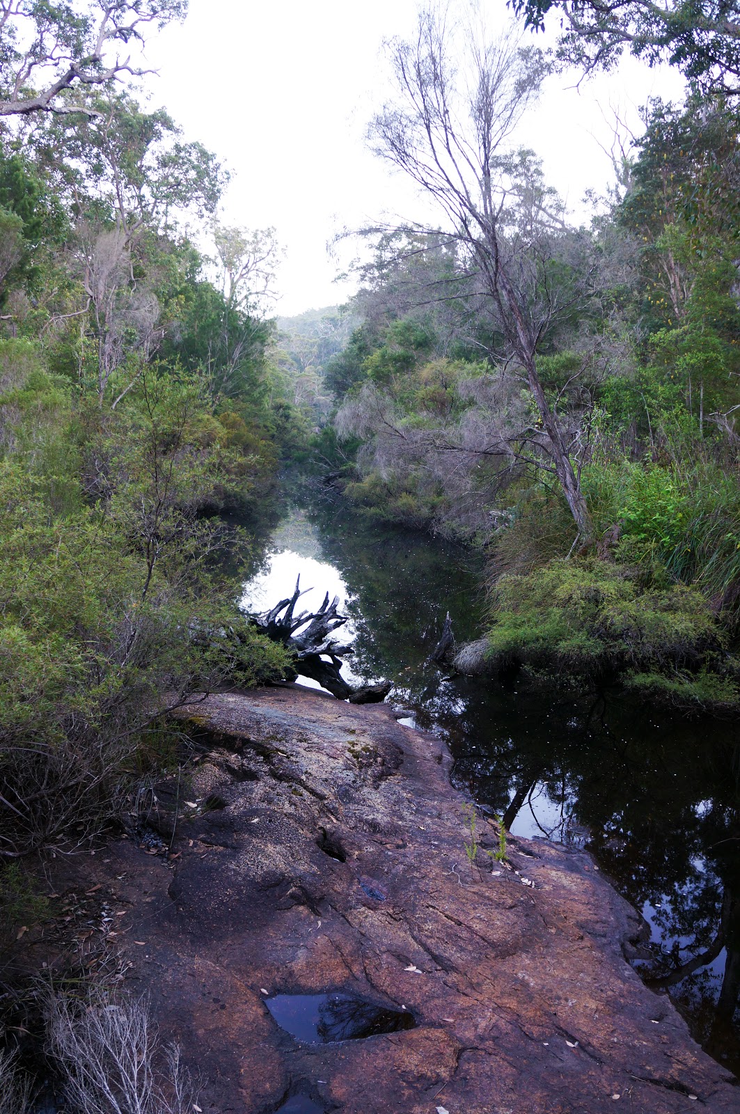
At this time of year (mid-Autumn), the river was still fairly low, though the narrowness of the river and the relatively low height of the bridge suggests the Denmark River never becomes the raging torrent of somewhere like the Frankland River.
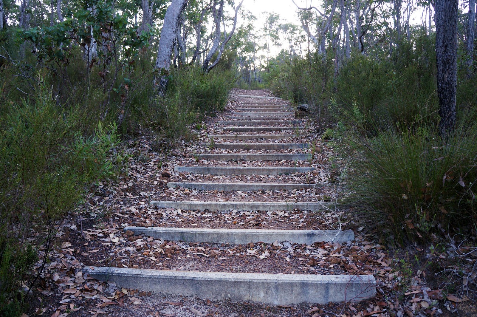
From the river, the trail rises at a moderately steep gradient up a series of stairs. This climb is relatively short however, and the trail levels out to a very gentle ascent through pleasant Jarrah forest.
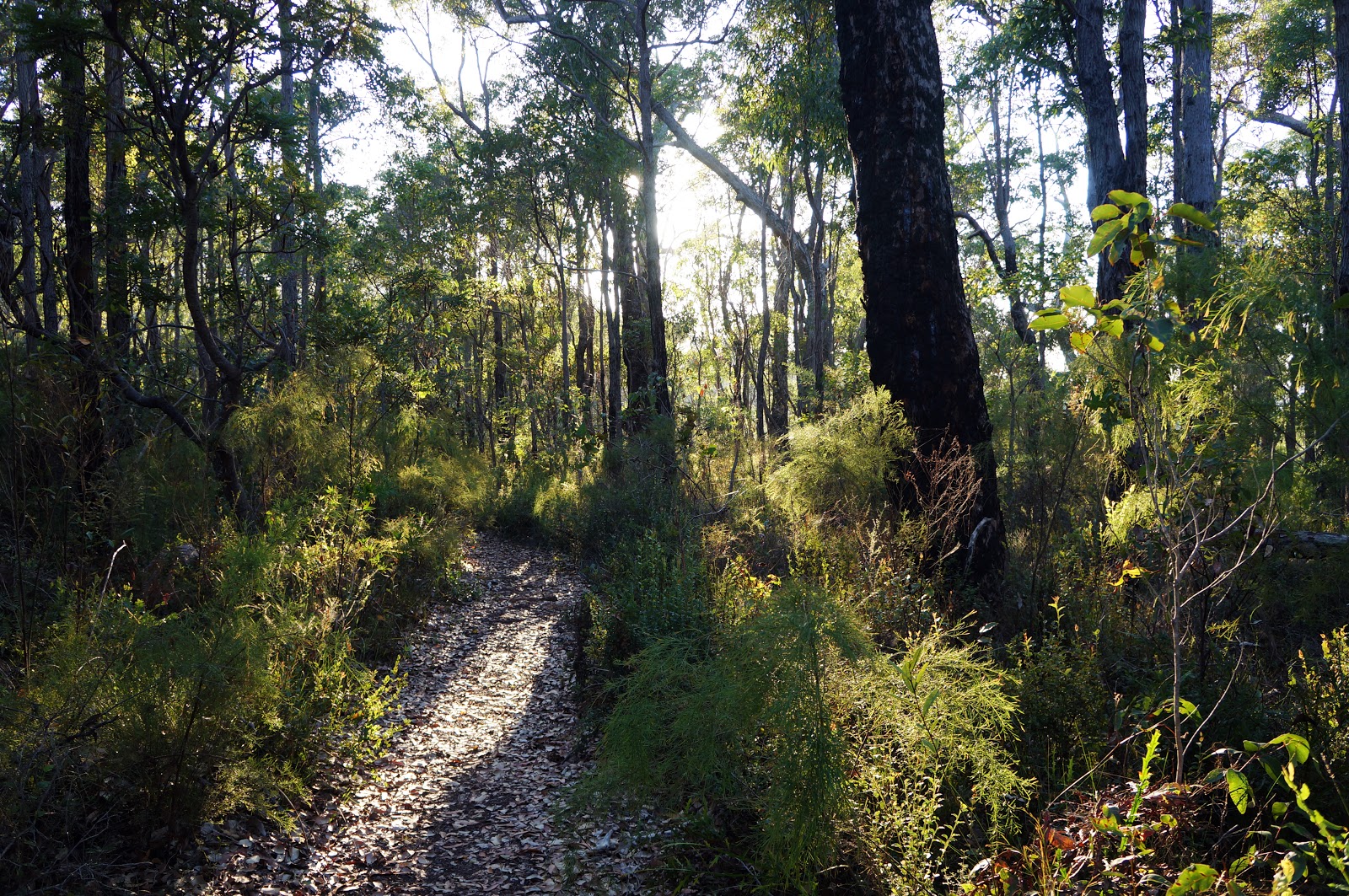
Superficially, the scrappiness of the Jarrah forest bears a resemblance to walking in the Darling Scarp, however the understorey plants are entirely different. Indeed, many of the plants in the National Park are rare and endemic to the region. Walkers familiar with the Karri and Tingle dominated areas of the Walpole Wilderness may find this forest less impressive due to its more stunted size, but the biodiversity on display reveals the park's importance as a conservation zone.

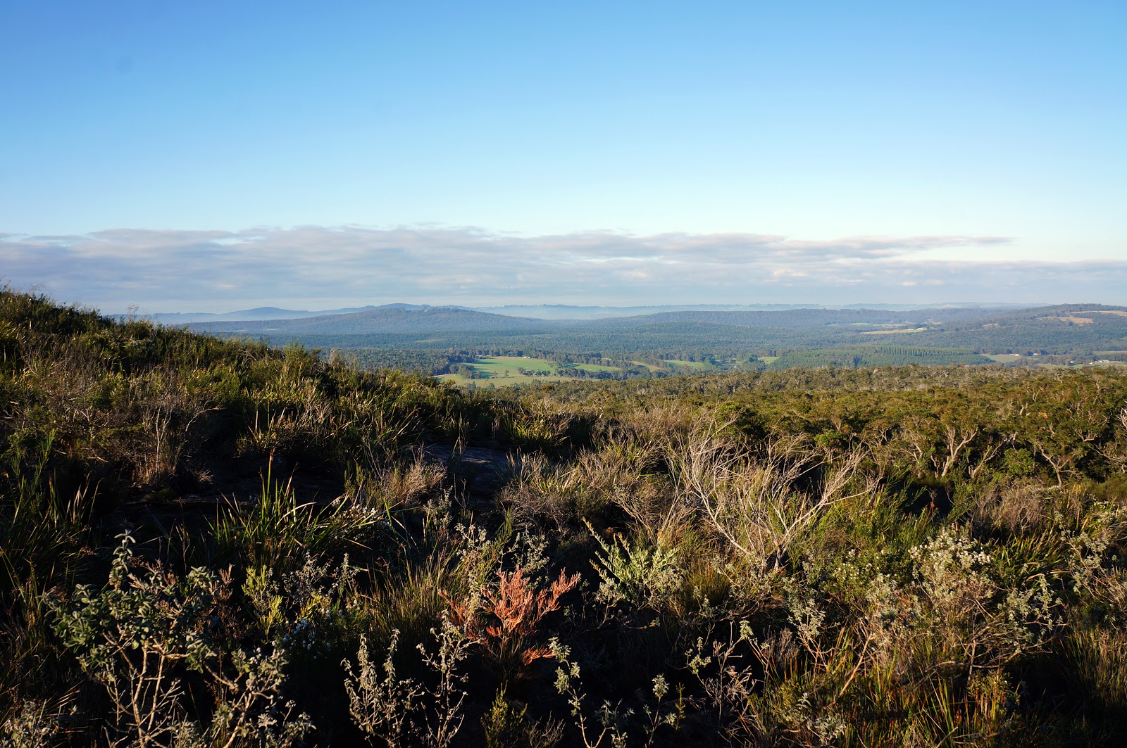
After a few pleasant kilometres in the forest, the trail heads into more open country, allowing for the first views of the rolling hills in the surrounding countryside.

This more open area marks the beginning of more challenging walking, as the trail crosses many large granite slopes. Some of these slopes are very steep, but the roughness of the granite offers an easy gripping surface while plastic marker poles serve as excellent waymarkers.

The granite slope sections are probably my favourite parts of this trail, as they introduce some challenge to the walk without being overly difficult. Although these slopes are the reason that DPaW rate this as a Class 4 walk, they are considerably easier than the similarly rated Bald Head Walk Trail and make Mt Lindesay an excellent trail for intermediate walkers looking to transition to more difficult terrain.
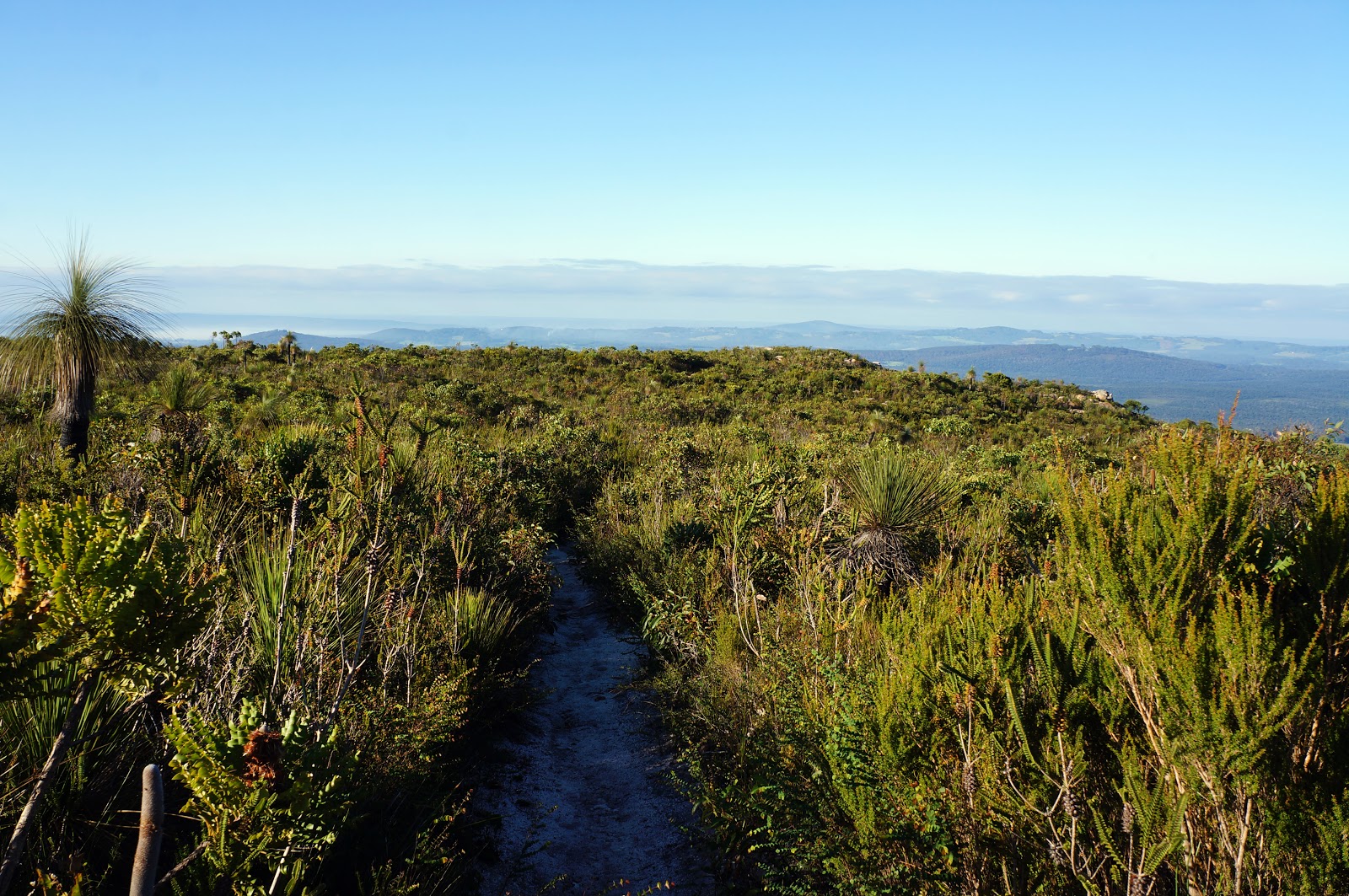
Closer to the summit, the large granite slopes give way to heathlands. Many of these plants were recognisable to us as they can also be found on Alissa's parents' property, and many of them are spectacular in Springtime when their flowers are in bloom. As is often the case in Western Australia, this walk would be even better when undertaken at the height of wildflower season.

Nevertheless, there is always something in bloom, and even in Autumn we encountered a number of wildflowers along the trail.
Near the summit, the trail reaches a fork that is meant to be a loop. At the time of our walk, this loop was incomplete due to being overgrown, and is thus more like a number of spurs. The spur to the left leads to an interesting granite outcrop overlooking the countryside. To climb onto the outcrop requires either a short bush bash or climbing over some boulders as the trail seems to be heavily overgrown.
Interestingly, the outcrop shows signs of a structure having been built on it some time in the past, with some cement and brick remnants still in place. We thought that there may have been a lookout here in a time before wilderness values became more widely accepted park management practice.
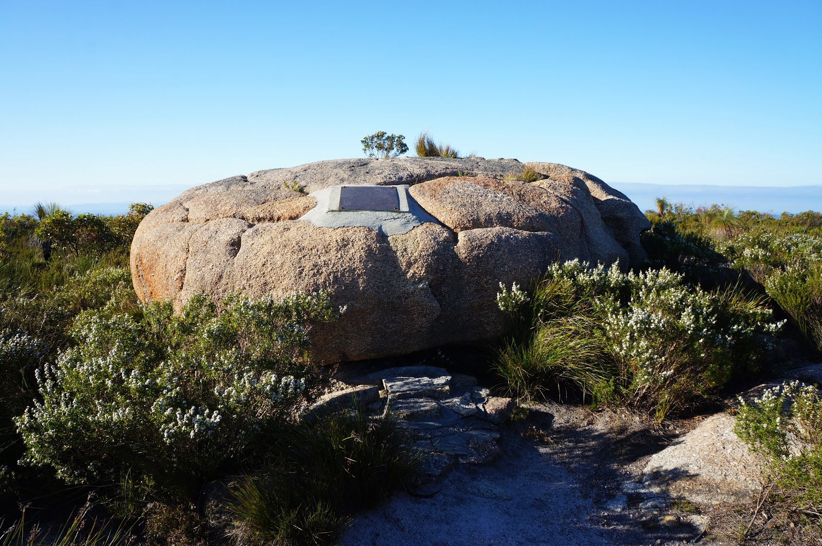
Taking the trail to the right leads to the summit cairn, which is actually just a single granite boulder.

A plaque on the rock explains the historical importance of the site, as it was from here that Thomas Braithwood Wilson became the first European to site the Denmark Townsite in 1829, as well as the point from which many of the nearby rivers and mountains were named. Placed here in 1979, the plaque makes claims of discovery that are historically inaccurate but typical of the time, since the Aboriginal people in the area would have discovered all these places long before the colonial era.

Climbing on top of the cairn, Alissa found the seal of Lands and Surveys WA bolted on top of the rock.
From the summit, the trail again branches in two directions. To the left, the trail leads to a dead end that presumably used to be part of the loop with the earlier spur to the left. Another trail from the summit appears to be an old vehicle track. We followed this track for a bit before realising it headed down the other side of Mt Lindesay and became increasingly rough. Along this section, we did see some very fine granite formations, including the landscape pictured above.

Additionally, as I stood on another granite boulder, Alissa and Jane called out to me to look up. Immediately above me was a Wedge Tailed Eagle soaring on the thermals, presumably investigating what I was doing in their territory. This photo does not do justice to how close the Eagle was to me, as I basically had to quickly shoot blind to photograph it. The Eagle flew further away and was joined by its mate shortly after, and we stood in awe at these majestic creatures in flight.

From there, we simply retraced our steps back for a relatively easy return walk to the trailhead.

Although we didn't see any of the marsupials that live in this area, Alissa did come across this neon yellow worm. Amazed by this strangely colourful creature, we thought it may have been a very young snake, however after searching online Alissa was able to ascertain that this was a terrestrial Planarian Worm - a type of carnivorous worm related to flatworms.
Overall, Mt Lindesay was a very enjoyable walk, and one that deserves to be better known. The changing scenery from Jarrah forests to granite slopes to heathlands makes this a varied walk, and the ramping up of difficulty over its decent distance makes it an excellent training ground for intermediate walkers looking to try out something with a bit more challenge. Given its heritage value, its proximity to Denmark and the abundance of wildflowers that would be in bloom in Springtime, it is perplexing why it has flown under the radar for so long.
The only disappointing thing for me was this:
I saw this video before we did this walk, and was excited by the landscape it depicted. As you can see from my photos, the heathlands-covered summit of Mt Lindesay is nothing like the large granite dome pictured above. We walked along the vehicle track hoping it led to this landscape, but gave up when we couldn't see anything that resembled the video's large expanse of granite. On our way back to the car, a sign advising walkers to be Dieback aware hinted at the answer - there is a second peak called Little Mt Lindesay. Sure enough; on closer inspection, the video does state in its description that it was filmed at Little Mt Lindesay. It doesn't take away from the walk we did, but it does mean that we'll hopefully be back in the future to check out this other amazing looking area.


Thank you for a very accurate and informative description of the track. We hiked Mt. Lindesay a few weeks ago. I believe little Mt Lindesay must be the area with the white posts showing the way. The granite dome is quite visible from below and also if you walk a bit further on the plateau than the actual summit trail. Enjoy your next hike!
ReplyDeletein winter if ever you findyourself at the small bridge at the river near the path to the mount ,travail the water edge, its not to easy but possible, the magical stones along the river can guide your steps,this a very mysterious place of great stones , a true spirit indeed. touch the stones with both and close your eyes , my journey here was very special and unforgettable,
ReplyDelete