

A sectional day walk through an area burnt by fires in February 2015, this intriguing walk on the Bibbulmun Track from Dale Rd to Brookton Hwy via Mt Dale campsite showcases a forest in regeneration. Marvel at clear delineations between areas severely burnt and those that were barely touched, and the way Eucalypts and Grass Trees can spring back to life even after such devastation.
Distance: 13 km (one way)
Gradient: Gentle gradient, with a mainly downhill trend. One minor ascent.
Quality of Path: Generally clear and well maintained considering how burnt it was.
Quality of Signage: Well signed, with the Waugal providing very clear directional information. Some Waugal markers were burnt and charred, but had been supplemented by new ones.
Experience Required: This section could be walked with little to no Bushwalking Experience
Time: 3.5 Hours
Steps: No steps that we can recall
Best Time to Visit: Now, before the forest regrows more (though avoid December-March inclusive due to risk of bushfire)
Entry Fee: No
Entry Fee: No
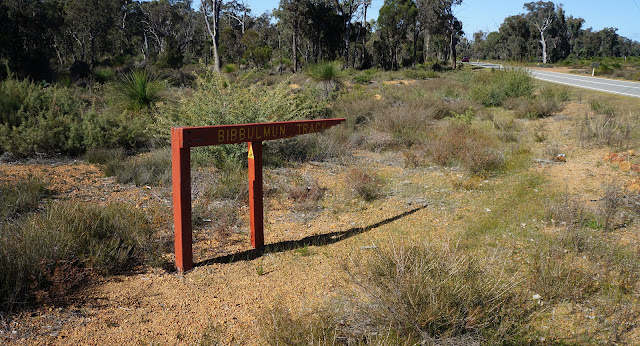
Getting There: Dale Rd is located off Ashendon Rd, which branches off from Brookton Hwy. Dale Rd is not signed, so you will need to zero your odometer as soon as you turn onto Ashendon Rd. 5 kilometres down the road, you should see a right turn. This is Dale Rd. Follow Dale Rd to the car park 10 kilometres later. The exit from the track at Brookton Hwy is beneath the powerlines at Powerline Rd. Bibbulmun Track signage is clear at this location and would be difficult to miss.


Although walking through burnt forest may seem unappealing, there was something quite photogenic about this walk from Dale Rd to Brookton Hwy, and it made a usually dull section of the track worth walking. While this area will eventually regrow and the signs of its recovery will become less pronounced, it really goes to show how organic and a 'living thing' walking a forest walk like the Bibbulmun Track can be - this was our experience of this section at the time we walked it, and it made for an intriguing sectional day walk.

The summer of 2015 was a horrid time for the Bibbulmun Track. Fires ravaged the section between Northcliffe and Walpole, the historic Long Gully Bridge was destroyed and Brookton Campsite - the only one that was wheelchair accessible - was burnt to the ground. When heading out for our two attempts at Marginata Rd to Brookton Hwy, Alissa and I saw a blackened expanse near where the hut was. Alissa and I had walked from Brookton Hwy to Mt Dale in 2012 as training for our Denmark to Albany hike and remember it as a fairly dull and ordinary section. Seeing this section so soon after such a major fire was of interest to us, as it would provide something of a different experience.
Dale Rd is a common access point for the Bibbulmun, however it is not the easiest one to find as the Dale Rd turn off is not signed from Ashendon Rd - see the above notes for how to get there. Once on Dale Rd, it is fairly easy to see where the Bibbulmun crosses the gravel road, and there were a few cars parked up here. Near this entry point, we saw a Dream Catcher tied to a tree and placed near what appeared to be a grave. The Dream Catcher and grave seemed oddly prescient - although far from the worst of it, this car park area showed some obvious fire damage with many trees blackened.

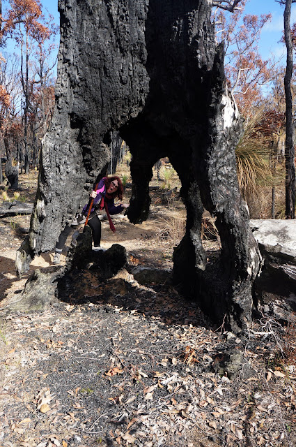
Heading down the slope to Mt Dale Campsite, we walked pass pockets of bush that had been severely singed.

With some areas looking like they had been quite seriously engulfed in flames.

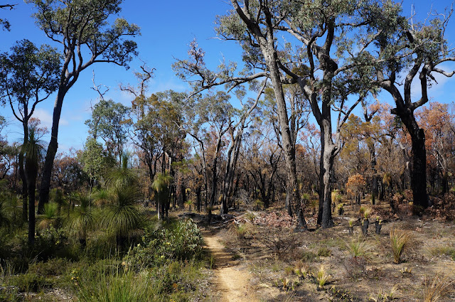
Interestingly, there were times where the areas that were burnt and those that were not could be clearly delineated along the path, showing how the track sometimes worked to prevent the spread of the fire.

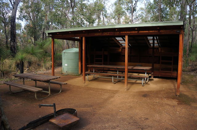
Mt Dale Hut thankfully got away from the fires unscathed, save for a reported smoky flavour to the water. Back in 2012, the area around the hut had been smouldering from a controlled burn, and I would suggest that this work to clear fuel from the site helped save it and the surrounding area from the flames.
Beyond the hut, the track continued through areas where the fires had again burnt forest on one side of the track while leaving the other unscathed.

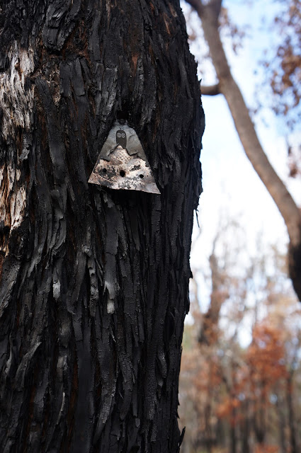
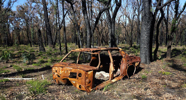
Devastating as the fires were, they created moments of ephemeral beauty, such as this burnt out stump of a tree that seemed to magically be standing upright in spite of being supported by the smallest amount of wood.


In time, the area will of course recover, and in about 10 years it will just look like stock-standard scrappy Darling Scarp forest. For now though, it was really interesting to see the area in the early stages of its return from the brink. Grass Trees had already begun to sprout again, and many Jarrah trees along the diversion around Brookton Campite were covered in Epicormic Buds, showing just how hardy the Jarrah Woodlands can be. Sadly the same cannot be said of other forests in Australia, with the destruction of Gondwanan rainforests over in Tasmania in 2016 being an irretrievable loss.


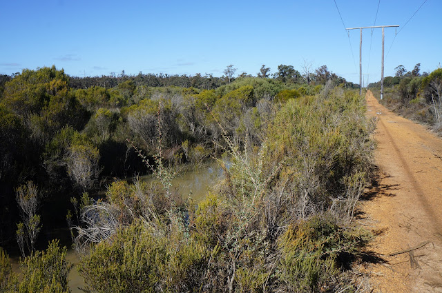
The diversion took us to Powerline Rd and reconnected with the Bibbulmun Track's normal route in the area. Although not as easy to photograph as it was shrouded by the growth along Powerline Rd, Alissa and I did spot the blacken area we had noted from Brookton Hwy as we walked back to our second car.


0 comments:
Post a Comment