

The final day of a seven day hike on the Bibbulmun Track, this double hut section takes walkers from the coast at Long Point to the town of Walpole. Initially passing through heathlands with spectacular coastal views, the track enters the lush Tingle forests as its climbs to the campsite at Mt Clare before entering a myriad of different landscapes on the way into town. An excellent end to the Northcliffe to Walpole stretch of the track
Distance: 23.7 km (one way)
Gradient: Very undulating through the coastal heath with some steep sections, then relatively flat to Mt Clare followed by a steep ascent and descent. Gently undulating to Walpole
Quality of Path: Largely clear and well maintained
Quality of Signage: Largely well signed, with the Waugal providing very clear directional information.
Experience Required: Previous Bushwalking Experience Recommended
Time: 7 Hours, including a snack break at Mt Clare
Steps: Some informal steps, with many formal steps from the coastal heath onwards
Best Time to Visit: All year, except for the peak of Summer and during particularly stormy Winter days.
Entry Fee: No
Getting There: This section was walked hut to hut. Walpole can be reached via South Western Hwy, with the traihead located near the Visitor's Centre in the middle of town. Entry Fee: No

While planning our Northcliffe to Walpole hike, Alissa and I discussed whether we should do the section in seven or eight days. Our last two major multi-day hikes had been eight days each (Balingup to Pemberton on the Bibbulmun and the Overland Track in Tasmania) and as such my original schedule had been an eight day version. The promise of getting a shower, non-dehydrated meals and a good night's sleep in a real bed eventually trumped having two short and easy days, and we agreed later in our planning that double hutting the last day was worth it. Wanting to get into town at a reasonable time to eat a celebratory '10 on a Plate' (more on that later), we decided to wake up over an hour before sunrise, eat muesli and Clif Bars so we didn't have to cook anything and get going as quickly as possible, leaving while it was still fairly dark out.

The two hikers we had met the previous day had warned us that the walking through the coastal heath would be fairly up and down in a manner similar to what we had encountered from Mandalay Beach to Long Point. Being so early in the morning, all the undulations proved to be a gift, with every dip and valley filled with mist.
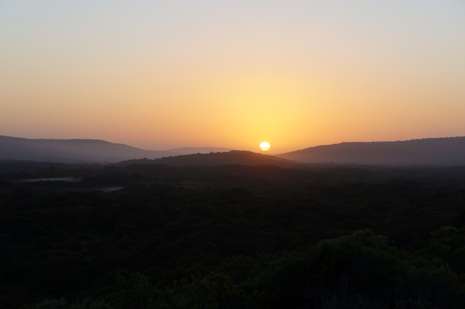
With Alissa and I heading eastwards, we were heading in the perfect direction to appreciate the sunrise as we made our way through the coastal heathlands.

Due to our early start, the first few kilometres of the walk were in fairly low visibility. With the sun out and the track heading closer to the coast, Alissa and I could make out the distinctive shape of Chatham Island in the distance.
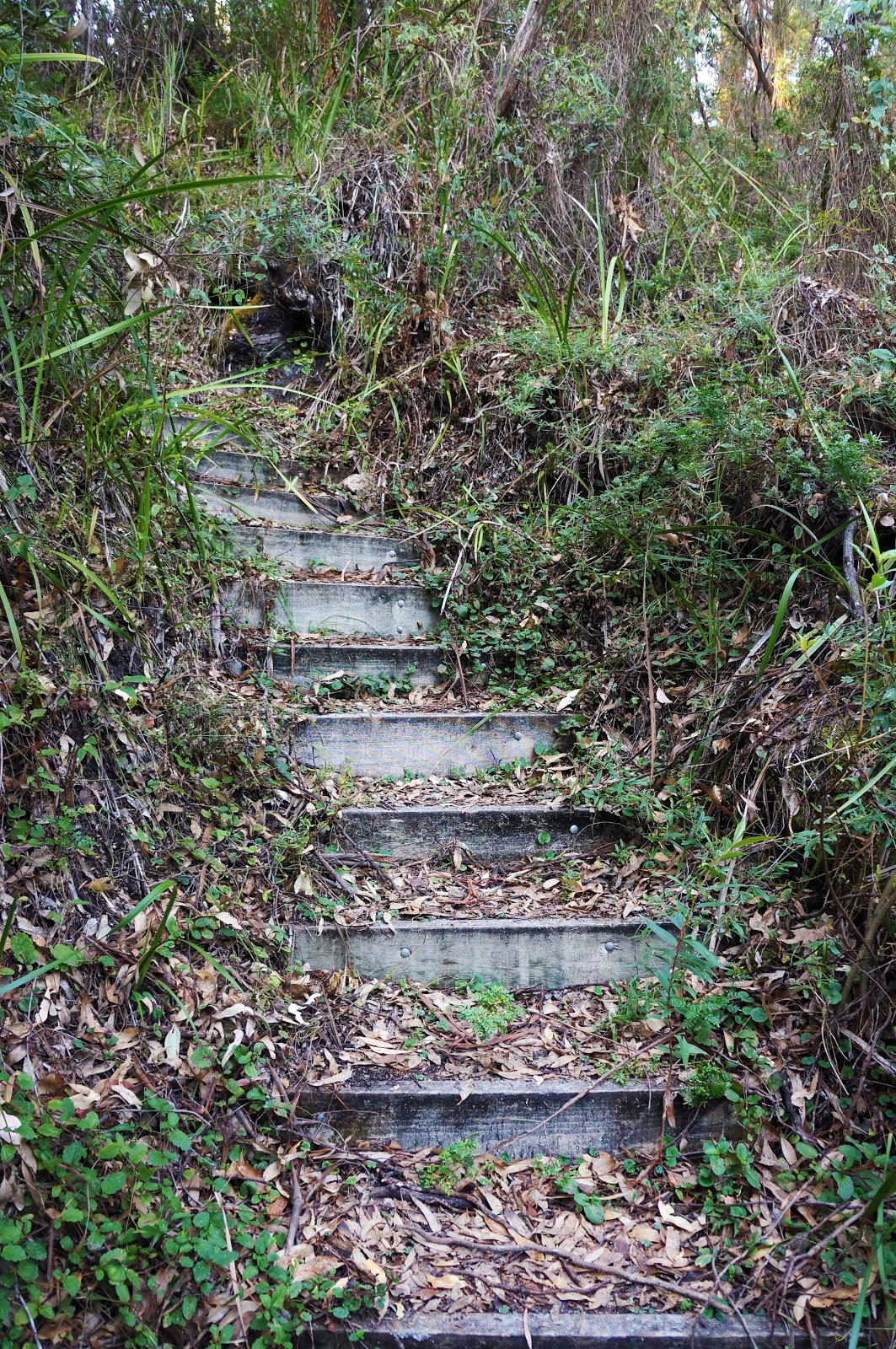
However before we would get closer to the coast, Alissa and I had some serious ascending to do. After entering a thicket of Coastal Peppermint, the track went up a steep series of steps.

Although very steep, the steps were at least short and sharp.

Or so we thought; although the steps through the Peppermint Thicket were indeed short and sharp, they were only the first set of steps, with the ascent continuing up several more as we continued up the ridge. The way the ascent was broken into several shorter steep climbs made me think a bit of walking the Main Range Track in Kosciuszko National Park, especially the section between Lake Albina and Mt Kosciuszko itself.

Once we reached the top of the ridge, the track reached a section of truly outstanding coastal walking.

The ridge provided fantastic views of Chatham Island, the wild Southern Ocean and the rocky coastline below, and would compare favourably with such great great coastal stretches along the Bibbulmun as Quarram Nature Reserve, West Cape Howe National Park and the rocky coastline between Rame Head and Peaceful Bay.

After following the ridge for some distance, the track gradually descends as it heads inland, eventually joining a broad track. This track is shared with the Nuyts Wilderness Trail, an overnight hike that explores a wild section of the nearby coast. Being a designated wilderness, the track had become fairly overgrown in recent years. At the time of our visit, DPaW had cleared the track with what must have been a fairly serious bulldozer, resulting in a broad track that was two cars wide! This seemed like serious overkill - while I would not call a terribly overgrown trail my favourite kind of walking, double wide vehicle track does not exactly scream 'wilderness'!

After following the broad vehicle track for 1.4 kilometres, the Bibbulmun turns off and follows some nice purpose built walk track as it enters a forested area. Initially filled with Jarrah and Blackbutt, the forest transitions to Karri.

The track descends slightly as it crosses Crystal Brook over a short bridge.

Although the smaller of the two crossings in the area, the views across Crystal Brook were spectacular, with Karri trees lining the idyllic water course.

Less than a kilometre later, the Bibbulmun crosses Deep River over a substantial suspension bridge.

The river views are fantastic, and made Alissa think about some of the great, tranquil sections of the Bibbulmun along the Donnelly and Warren Rivers.

On the other side of the bridge is the trailhead for the Nuyts Wilderness Trail. Although a fairly obscure trail compared to the Bibbulmun, Cape to Cape and even the Stirling Ridge Walk, the trailhead's signage is surprisingly comprehensive, providing information for various different walks in the area including some overnight hikes.

Beyond the trailhead, the Bibbulmun crosses a vehicle track and car park as it head up towards Mt Clare. the views along the vehicle track are fantastic as it is lined with tall mature Karri forest.

Not long after crossing the vehicle track, the Bibbulmun begins its ascent up Mt Clare. Although relatively steep, the constant switchbacks made it easier than Alissa and I had expected.

Along the ascent, Alissa and I saw the first Tingle Trees of the track. These giants trees and their buttressed bases are a major feature of the forests between Walpole and just beyond Giants campsite, and are some of the most impressive trees in Western Australia due to their massive size, with the Giant Tingle being a notably gigantic example that lives up to its name.

I was surprised to find myself at Mt Clare campsite in far less time than I expected, and I enjoyed being able to take my pack off as I explored the area around the campsite.

Although small in comparison to some of the more elaborate campsites along the track, Mt Clare would have to be a contender for one of the Bibbulmun's best. Arguably better than the other Tingle-dominated campsite at Giants, Mt Clare features a broad open plan area near the hut that includes some fantastic campsites beneath the Tingles. Although I don't regret our decision to double hut it into Walpole, Mt Clare is such a superb location that I wish we could have had to pleasure of staying there.

After a bit of a snack break at Mt Clare's hut reading the Red Book, Alissa and I continued along the track to Walpole. Not far from the campsite is a short side trip to the actual summit of Mt Clare itself.

The summit is a large expanse of granite, and has a similar appearance to the other granite domes I had climbed over the last few days from Mt Chance to the hill behind Woolbales hut.

Back on the Bibbulmun, the track descends Mt Clare through a beautiful mix of Karri and Tingle forest. Although a fairly broad vehicle track, the walking was so scenic that it didn't much matter that it wasn't a single file trail.

Once down from Mt Clare, the Bibbulmun crosses a road and then uses a service track that runs above buried electric cabling. Dotted with 'Do Not Excavate' signs and densely vegetated, this was probably the weakest part of the day's walking so far, however it was still pleasant enough.

Once we cleared the service track, we reentered lovely Tingle forest, reminding Alissa and I very much of the walking from Giants to Frankland.

Along the way, the track passes Rates Lookout which provides a glimpse of the Walpole Inlet in the distance. The view is not bad, however the forest is so dense that the views are somewhat obscured. As such, I feel that the Hilltop Lookout on the other side of Walpole is a superior lookout point.

From Rates Lookout, the lush, dense Tingle and Karri forests give way to sandier soils filled with Jarrah.

As we continued on, the Jarrah slowly gave way to open plains, providing something of a reprise of the Pingerup Plains-style walking that is unique to the Northcliffe to Walpole stretch of the track.

Closer to Walpole, the Karri forests return once more as we crossed Rest Point Rd. We were now on the home stretch with only three kilometres left of walking until we reached the Walpole trailhead!

But before that, Alissa and I were gifted with one of the more unusual sights along the track as the Bibbulmun makes its way through the local golf course!

On the other side of the golf course, the track runs concurrently with a short local nature trail, with much of it under boardwalks as it reaches an impressive wooden bridge that crosses the Walpole River. A photo of this bridge features in the old chunky guidebooks so it was a real treat to finally be crossing it after all these years.

On the other side of the river, the walking is fairly ordinary as it follows a service track alongside the powerlines. Due to land use constraints, the stretches heading into town are often some of the dullest bits of the Bibbulmun Track, so we were not surprised by this boring corridor along the home stretch. Heading into Walpole in the other direction is no better either - the hard, dual use track from Coalmine Beach is one of our least favourite walks into town along the whole track!

The track passes several houses with excellent views of the Walpole Inlet. That being said, the inlet views are admittedly superior on the other side of Walpole heading towards Frankland.

Over the last few hundred metres, the track passes through a lovely section of Paperbark wetlands.
On the other side of the wetlands, the Bibbulmun reaches the outskirts of Walpole. From here its a short walk through the main park in town to the visitor's centre and the end of this town to town section. With Northcliffe to Walpole completed, Alissa and I have now done every section from Balingup through to Albany - the Southern Half is complete! Now we just have eleven more days of hiking to fill in some of the gaps between North Bannister and Balingup to go before we've successfully completed our sectional End to End. Almost there!

To celebrate the end of our hike, Alissa and I indulged in what I refer to as a '10 on a Plate' - a Sausage Roll and a Pie lined up to look like the number 10. Being Good Friday, we weren't sure if anything in town would be open, however with so many tourists out and about business was absolutely booming, with most shops open. After eating or pies and sausage rolls, Alissa's parents arrived from Denmark to take us to showers, comfortable beds and a lovely home cooked dinner as we spent the Easter weekend with them.
In spite of some ordinary walking along service tracks, the vast majority of Long Point to Walpole featured excellent walking that had a lot in common with the fantastic stretch of the track from Walpole to Denmark due to the predominance of spectacular coastal walking and the Tingle and Karri forests. Although we did this as a double hut section, Mandalay Beach to Walpole would be a great three day hike for beginners to get a taste of the track; it provides a good bite-sized sample of what makes the Walpole area so special, and made quite achievable due to relatively short days of walking.
I'm glad that our Northcliffe to Walpole hike ended on a high note. Most of the first four days featured fairly uninspiring walking, however the last three days from Mt Chance onwards made up for it with everything from beautiful plains, granite peaks, coastal views and stunning forests. I would still rate Walpole to Denmark and Balingup to Pemberton as better town to town stretches of the track (I'd even put Kalamunda to North Bannister up there as well), but this was as good a three day stretch of the track as can be found in any of the above and would be highly recommended.


I walked Mandalay Beach to Walpole several years ago staying overnight at Long Point and Mt Clare and then Walpole. It rained the entire time! Mt Clare was a lovely overnight stop. We were up in the clouds in that damp weather (October when it can be winter or midsummer conditions or both in quick succession). My favourite part was the suspension bridge and the climb up My Clare in the giant tingle forest. Magnificent! Thanks for your blog. Brought back happy walking memories.
ReplyDeleteNo worries Sandy! Its a beautiful area for sure, and I would definitely consider doing Mandalay Beach to Walpole again - this time with an overnight stay at Mt Clare.
ReplyDeleteSorry to take 4 years to read - but thoroughly enjoyed the recount of your trip - important in my own preparations for this section. Some great insights. You got me pondering to double hut at the end or not. In retrospect- what is the best direction you reckon ! N2S of S2N?
ReplyDeleteAs much as I love the Bibb Track - sometimes I do feel let down by it - not as pretty and well laid out as it could be.
I walked Albany to Walpole and this section was better than the combined section of Perth to Balingup. And I probably even enjoyed the Cape to Cape more than the Bibb Track (earlier sections). I think it comes down to coast is king.
Anyway / Well done on a great blog.
Sorry to take 4 years to read - but thoroughly enjoyed the recount of your trip - important in my own preparations for this section. Some great insights. You got me pondering to double hut at the end or not. In retrospect- what is the best direction you reckon ! N2S of S2N?
ReplyDeleteAs much as I love the Bibb Track - sometimes I do feel let down by it - not as pretty and well laid out as it could be.
I walked Albany to Walpole and this section was better than the combined section of Perth to Balingup. And I probably even enjoyed the Cape to Cape more than the Bibb Track (earlier sections). I think it comes down to coast is king.
Anyway / Well done on a great blog.