

Day two of a seven day thru-hike of the Cape to Cape Track, this relatively challenging day on the track takes walkers from Yallingup to the campsite at Moses Rock. Crossing several brooks over the course of the day, the track passes by some of the most rugged granite-dominated landscapes of the entire track, including such highlights as Smiths Point, Canal Rocks and Quininup Falls. Another scenic day of walking the Leeuwin-Naturaliste coast.
Distance: 20.25 km (one way)
Gradient: Some moderate descents and ascents throughout the length of the walk
Quality of Path: Largely clear and well maintained. Some uneven sections with rocky limestone surfaces
Quality of Signage: Largely well signed, with the the Cape to Cape Track markers allowing walkers to remain on track (albeit lacking in directional information). Some lack of clarity at beach exits
Experience Required: Previous Bushwalking Experience Recommended
Time: 6 Hours
Steps: Many steps, especially leading to and from beaches
Best Time to Visit: Late Autumn/Early Spring
Entry Fee: No
Getting There: Yallingup can be reached on Yallingup Beach Rd via Caves Rd. No direct access to Moses Rock campsite.Entry Fee: No
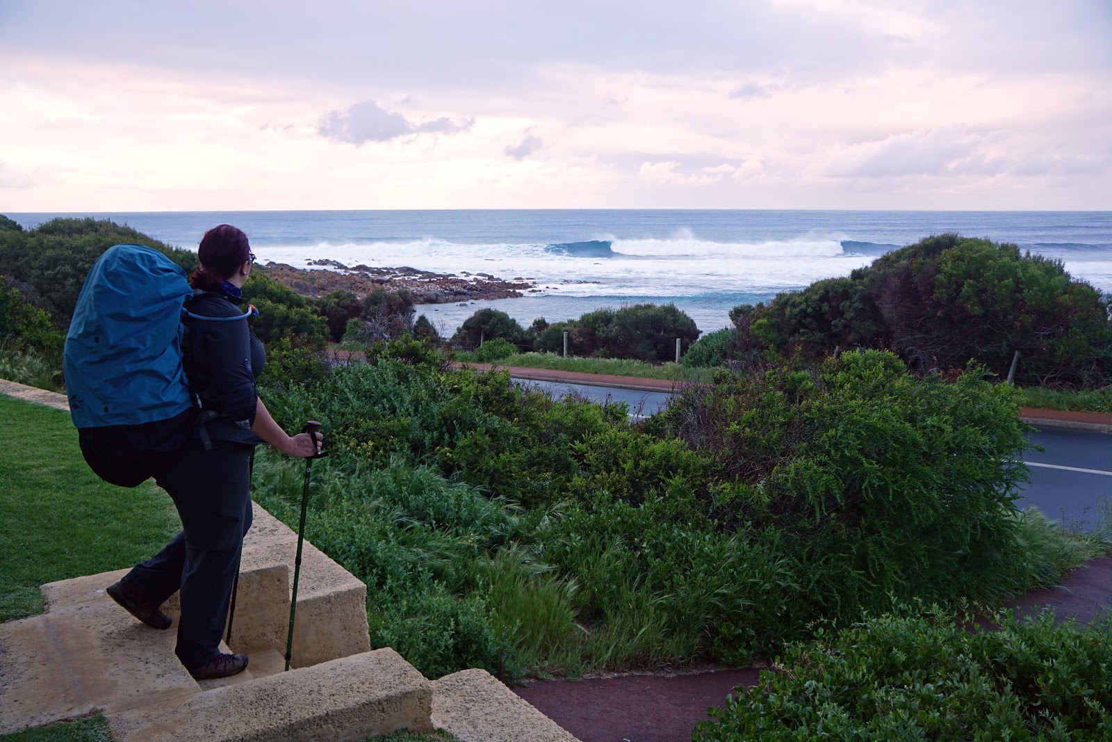
After a relatively easy first day and a relaxing evening in our cabin enjoying wine and television, Alissa and I woke up early to tackle the 20.25 kilometre second day of our Cape to Cape hike. After returning our key, Alissa and I were able to walk straight from our cabin and back onto the track, which runs alongside Yallingup Beach Rd as it crosses Yallingup Brook via a road bridge. This was the first and most uneventful brook/river crossing of the track, and we would encounter three more over the course of the day.

After passing a small car park, the Cape to Cape overlooks a section of rugged coastline. The main feature of the granite headlands in this area is Torpedo Rocks (pictured above) - a narrow rock formation that looks like a torpedo sticking out into the Indian Ocean. Its appearance is like a very small and less impressive version of Canal Rocks - one of the major sights we would be passing by later in the day.

As we were nearing the end of the granite headlands, Alissa and I were approached by Allan and Adrian - two hikers we'd spoken to briefly the previous day after meeting them as we passed Mt Duckworth campsite. Allan and Adrian had met on the bus to Dunsborough and were hiking a similar itinerary to Alissa and I right up until Contos campsite, and our paths would continue to intersect throughout the course of our walk. Allan was originally from Victoria but lives in Perth, while Adrian was a Spaniard living in Melbourne who had come over to the west coast just to do the Cape to Cape Track.

Descending to Smiths Beach, the track passes the Smiths Super Tubes. We would encounter more of these limestone formations further along the track, especially during our last three days.

Towards the end of Smiths Beach, the track crosses Gunyulgup Brook. Little more than ankle deep, this was the first brook crossing we had to wade, and reminded us that we had a potentially challenging and dangerous crossing the next day as we needed to cross the Margaret River mouth at Prevelly. While we had reports that Margaret River was no more than knee deep over the previous week, 20mm of rain was forecast overnight and we were worried about getting stuck on the north bank of the river with no choice but to take a long diversion. With a long third day planned, we did not need to add any more kilometres to our day, and we decided to call Gene from Cape to Cape Explorers to see if he could provide us with advice and possibly be at hand to help us cross with kayaks.

Gene was initially skeptical about us being able to walk the 30+ kilometres in one day, but was very helpful in providing us information about the crossing and the kayak service. Given the public liability risk, Gene could not outright tell us whether or not we should do the crossing but did advise that the combination of fast flowing river and rips can be a treacherous combination. With the next day being a public holiday and Gene not being in the area at the time we would be crossing, he advised that the cost of the kayak service would be quite expensive but that it might be worth the cost to us rather than taking the diversion or putting ourselves in danger. Still not sure what to do, Gene offered to take a photo of what the river crossing looked like so we could make an informed decision about the risk. I thanked him for his help and advised that we would make a decision later in the afternoon once we received his photo.

Beyond Smiths Beach the track passes through some beautifully rugged granite-dominated terrain at Smiths Point.

This was a major highlight of the day's walking, and one of our friends listed this was one of her favourite sections of the Cape to Cape. I can definitely see why - as a fan of rugged terrain this was a very memorable stretch of the track.

As we made our way up and across the rocks, Alissa and I were rewarded by some spectacular views of Canal Rocks in the distance.

Curiously, the track does not actually go to Canal Rocks and instead crosses Canal Rocks Rd about 500 metres up the road. With rain forecast to hit from 2pm onwards, Alissa and I were keen to get a move on and didn't take the side trip to Canal Rocks on this occasion as we had seen it before.
Post from RICOH THETA. - Spherical Image - RICOH THETA
That being said, if you've never been to Canal Rocks before and are not chasing the weather, I would thoroughly recommend taking the short detour as it is one of the more action packed natural features of the Leeuwin-Naturaliste coast. It's really cool watching the waves crash into the rocks, and during particularly strong swells the surge of water can even come crashing through the bridge!

After crossing the road, the track rises up alongside a large limestone boulder and leads to an excellent lookout point.

For those who did not take the side trip to see Canal Rocks up close, the lookout provides the best view of the rocks from the track itself.

From the lookout, the track follows a limestone ridge that has quite uneven surfaces. Alissa had been anxious about having to set up the rain in the tent, and the 2pm deadline had spurred me on to rush through the area as fast as possible. Alissa was falling behind given the uneven surfaces and it led to us having an argument as I was encouraging Alissa to walk faster when she was struggling to keep up. She thought I was being unreasonably pushy, while my entire reason for walking faster was really for her benefit as I didn't care about setting up the tent in the rain as much as she did. Eventually we agreed we'd go as fast as possible without overdoing it, and just hope that we'd make good enough speed to beat the rain to Moses Rock campsite.

From the limestone ridge, the track descends steeply before heading along the rocky beach below.

Continuing along the mix of granite and limestone ruggedness, the track crosses Wyadup Brook via a series of very large granite stepping stones. Water flow was little more than a trickle heading through the rocks, and I can't imagine this ever being a particularly tricky crossing even at the height of winter.

After passing a fenced off field, the track overlooks a series of impressively large granite formations that are similar to those found at Smiths Point.

These rocks leading up to Injidup Beach appear to be very popular with surfers, and we saw quite a few catching the waves just off shore.

The track descends to Injidup Beach. While the Cape to Cape Track markers are generally quite easy to follow, Injidup Beach is a classic example of how confusing the beach exits can be along the track. As you walk along the beach, a series of steps appear to be the most logical beach exit point, however the track actually leaves the beach about 150 metres later via a less conspicuous 4WD track. This is one area where the Cape to Cape Track signage could be a lot better as it means you really need to refer to the guidebook whenever you reach a beach. A great solution would be for the more unclear beach exits to be marked with the tall orange posts used on the Bibbulmun Track and the Mamang Trail in Fitzgerald River National Park.

After rising up off the beach, the Cape to Cape passes through a tunnel of tea trees and then ascends a series of stairs before joining a vehicle track.

The vehicle track is not overly exciting in and of itself, however it did offer us one of the most exciting sightings of our walk - WHALES! Alissa and I have done many coastal walks over the years but we've never been lucky enough to spot whales while out on a hike. Although too far off in the distance to photograph clearly, we distinctly saw at least three whales breaching and spurting up water off the coast. During this stretch, we also ran into our first snake - a juvenile carpet python that slithered away after realising we were nearby.

The vehicle track goes on for several kilometres, and by this stage the foot pain that had flared up during the last two days of our Bibbulmun Track sectional End to End had returned and led to severe pain on the outer side of my left foot. Descending to Quininup Beach made things even worse, as it meant putting more pressure on my left foot's outer side due to the uneven slope heading southwards along the beach.


Quininup Brook was our last wading crossing for the day, being no more than ankle deep.

With my foot being in a lot of pain and Alissa and I still hoping to beat the weather to Moses Rock campsite, we decided not to take the side trip to Quininup Falls, located upstream of Quininup Brook and less than a kilometre from the track. We'd already covered Quininup Falls as a day hike last year so weren't missing out, however I would recommend the side trip if you've never seen these falls in action. For me, they are probably one of the more impressive waterfalls in the South West, and an unusual one as its located so close to the beach.

Having already walked to Quininup Falls before, Alissa and I were dreading the next part of the walk - a very steep climb up some soft sand dunes. These dunes were not a lot of fun when we visited them before with a day pack and were considerably more difficult with a week's worth of supplies on this occasion. Thankfully, the dunes are fairly brief and it isn't long before the track runs along the cliff tops once again.

The track from Quininup Brook to Moses Rock car park is the muddiest part of the whole track, and I would hazard a guess that this is due to the number of day walk visitors heading to Quininup Falls. There are some parts that are so muddy you'd be forgiven for thinking you're in Tasmania, even if it is never more than ankle deep.

A number of small creeks run across the track in this section, with bridges providing easy crossings. These minor streams run to the beaches below, with exposed granite along the cliff tops continuing the impressively rugged scenery that had been the theme of the day. As we approached Moses Rock car park, I received a message from Gene with photos of the Margaret River crossing looking to be about knee deep. With all the rain forecast, Alissa and I were thinking it could be as much as waist deep the next day. Given the cost of getting a kayak out and the uncertainty of the situation, we decided it might be better to cut our losses and take the winter detour. We thanked Gene and advised him of our plans, which he described as a 'good call'.

Beyond Moses Rock car park, the track runs along some 4WD track before running along more single file walking track. The track passes a low key lookout, but the views were decidedly ordinary even if the coastal heath flowers nearby were quite beautiful. Although its only a few kilometres from the car park to the campsite, the anticipation of the walk almost being over made it seem twice as long. Every tea tree thicket got us excited only to be let down when we realised we were not there yet!

Running into Allan and Adrian setting up their tents was a cause for celebration, as it confirmed that we were finally at Moses Rock campsite. Nestled under a grove of tea trees, it would be a nice place to camp if it were not for the muddiness of the ground at the time of our visit. Much to Alissa's relief, we'd largely beaten the rain to the campsite, with only a very minor drizzle as we set up our tents and bedding. Given the rain forecast, we decided to eat our Backcountry dinners for lunch while it wasn't raining heavily an eat a light no-cook dinner. This proved to be a very good decision; while it was no where near as heavy as the forecasts suggested, we were hit by continuous light rain from the afternoon onwards. This unfortunately meant being tent-bound for the rest of the day, with Alissa and I playing games on her phone and reading the guidebook repeatedly to kill the time.
At the time, Alissa and I agreed that Yallingup to Moses Rock was quite a difficult day, and we've since found that quite a few other walkers have agreed with this assessment. Looking back at it, I'm not sure whether the day was objectively more difficult than other days or whether extrinsic factors played a role in the difficulty, such as it being the second day after a very easy first day, Alissa's anxiety about setting up in the rain and my foot pain. While Sugarloaf Rock is probably the most dramatic granite formation of the track, this day probably features the greatest number of smaller granite rock features along its length, with Smiths Point, Canal Rocks and Quininup Falls being major highlights. In spite of the difficulty, the scenery was again outstanding - quite possibly upping the ante of day one.


0 comments:
Post a Comment