

The second day of an overnight hike on the Bibbulmun Track, this day of walking links Tower Hill in William Bay National Park to the outskirts of the Town of Denmark. Featuring impressively massive granite formations over much of its 20 km, this spectacular and highly varied section takes walkers from coastal heath and sweeping beach vistas to Karri forest and mountain views on Mt Hallowell. One of the Bibbulmun Track's finest.
Distance: 20 km (one way)
Gradient: Varied. Largely gentle and moderate inclines up to and after Mt Hallowell, while Mt Hallowell itself is very steep and challenging at points.
Quality of Path: Relatively clear and straightforward, although the rocky terrain on Mt Hallowell is highly uneven.
Quality of Signage: Largely well signed, with the Waugal providing very clear directional information. Some lack of signage near the end entering Denmark.
Experience Required: Previous Bushwalking Experience Required.
Time: 7 Hours, including lunch
Steps: Some steps, mainly near Lights Beach and towards town
Best Time to Visit: Autumn and Spring, and milder Winter days
Entry Fee: No
Entry Fee: No
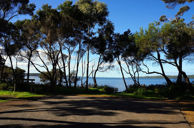
Getting There: Access to William Bay campsite via William Bay Rd off South Coast Hwy. Denmark Trailhead is on Hollings Rd off South Coast Hwy, right on the banks of the Denmark River.

After a better than average night's sleep at William Bay thanks to our new sleep systems, Alissa and I were keen to continue our journey into Denmark - thus completing the Walpole to Denmark Town to Town section of the track together. After packing our bags and a quick breakfast, we were on our way with golden hour gifting the landscape around us with its lovely glow.

Just beyond the campsite, a short spur leads to a lookout. The lookout offers sweeping views of Mazzoletti Beach as well as views of impressive granite rock formations, such as those in the photo above. The photo does not do justice to the size of the two formations in the background, with the one to the left looking like a massive stone shark's fin. I would love to hear the Dreaming stories about this area (and the fin rock in particular) as I'm sure it would be fascinating.
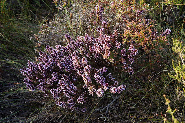
The first few kilometres of the walk are in coastal heathlands. While this area would be more spectacular in springtime, many plants were already flowering in early winter. Following the gentle rising and falling gradient, the heathlands offer many impressive views of the rugged coastline, with Madfish Bay and the distinctive Madfish Island being obvious landmarks.

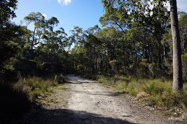
A few kilometres in, the track briefly enters a forested area, providing an interesting change of pace from the heathland that dominates the Bibbulmun from Conspicuous Beach onwards.

Hidden by the trees, walking into the forest reveals incredibly large granite formations within, as well as this oddly swollen tree that gives the impression that it is trying to take on the appearance of the rocks it leans towards.

This landscape of smooth, white barked Eucalypts and massive granite formations is to me quintessential Australia bush, and it gives credence to my view that the long way really is better - you would never see these formations unless walking the Bibbulmun Track.

If the last photo does not give due credit to the size of the formations, this one should. The sheer size of the rocks dwarfed Alissa and I, and yet we were to encounter even large formations further along this section.

The track leaves the forest and returns to heath leading to Lights Beach.

The route down the dune at Lights Beach had been completely washed away to a short cliff, and we followed the makeshift path that other hikers had already trodden for a more even descent.

Given the obvious force of nature, it was incredible to find the waters as peaceful and tranquil as they were, with the bay protected from the wild Southern Ocean by the low granite rocks.

Nevertheless, the stairs leading to Lights Beach car park again revealed how storms had eroded the beach, with the first step over a metre from the ground and a stream flowing into the ocean right beneath it!

From the car park, the trail rises for spectacular views of the coast, with this beach in particular being one of the prettiest along this stretch of the track.

After providing coastal views, the track heads inland to an area badly effected by Dieback. Information signage show photos from a few years ago, and comparing it with the landscape today is heartbreakingly sad. A short distance later, walkers climb a stile into a public right-of-way through farmland.

Although an unnatural landscape, this stretch of the track that passes alongside pastures gives the day of walking even more variety. With the perfect weather we were gifted with, the landscape looked absolutely idyllic.

After climbing over another stile, the track crosses Lights Beach Rd, leading to the ascent of Monkey Rock and Mt Hallowell in Mt Hallowell Reserve. When I walked Walpole to Denmark in 2003, my friends and I were in such a rush to get to Denmark that I have to admit we walked around this section - something I have always regretted. This time, I had a chance to make things right, and I'm glad to say that it is arguably the best part of this day of walking.

The Bibbulmun runs concurrently with the Sheila Hill Memorial Track through Karri forests. Other than a few scattered forests on the way to Denmark, this is the last significant stand of Karri along the track heading towards Albany.

The track rises quickly and steeply, leading to enormous granite mounds. A number of rock climbers were scaling this part of Monkey Rock, and they provide some sense of scale for the size of the formation.

The track skirts Monkey Rock with no actual signage indicating that there is a spur, however it is well worth climbing onto the rock as it provides spectacular views across the landscape. To the south-west, walkers can see the landscape they have just traversed while the Wilson Inlet and West Cape Howe are visible to the south-east.

Monkey Rock also provides walkers with views to the top of Mt Hallowell, indicating that there is much more ascending to be done.

The Karri trees lining the track up Mt Hallowell are beautiful, reminding Alissa and I of Porongurup National Park. In fact, with the Porongurups still recovering from the horrendous 2007 bushfire that defoliated much of the forest canopy, the trees on Mt Hallowell appear significantly older and healthier. The result is an arguably more pleasant walk up to the summit compared to the Granite Skywalk, even if the Skywalk's Castle Rock is still more spectacular.

The understorey also features many interesting sites, including this particularly bright cluster of mushrooms growing alongside the track.

The route of the track is well considered, with many opportunities for expansive views of the Wilson Inlet and the Nullaki Peninsula. Walkers keen to cross the inlet to Nullaki can get a decent view of the sandbar across the river mouth, with West Cape Howe in the distance.

The terrain gets increasingly rough and boulder-filled on the way up, and I would hazard a guess that this would be considered a Class 4 walk on the Australian Walking Track Grading System. Near the highest point of the track, a short spur leads to the summit of Mt Hallowell itself.

At just under 300 metres in height, Mt Hallowell is hardly a true mountain, however it provides spectacular 270° views across the landscape, taking in everything from the rolling farmland that surrounds Denmark to the rugged coast.

To the south-east, Denmark's two wind turbines can be seen - a precursor to the iconic wind farm further along the coast that indicates to walkers that Albany is not far away. With lovely weather and great views, Alissa and I stopped for lunch here and chatted to other walkers enjoying time out on the Sheila Hill Track.

Continuing back on the Bibbulmun, the track begins its descent, offering even more superb views of the mature Karri forest.

The route down the mountain is the long way down, as there are points where the track actually descends only to rise yet again! Although less steep and difficult than Toolbrunup or Talyuberlup in the Stirling Range, this descent proved to be particularly treacherous; both Alissa and I slipped and fell at different points, with Alissa breaking one of her new trekking poles and me spraining my right wrist. This is definitely terrain that needs to be treated with some respect and caution.


Reaching the bottom of Mt Hallowell, the track briefly enters residential areas.
Following the track along residential roads, many of the houses in the area are very pretty, with many located right along the inlet. At the end of road called Rainbow Close, the Bibbulmun follows a track along the Wilson Inlet.

This is yet another great change of pace as it follow the wetlands along the inlet's banks. This trail provides an interesting snapshot into the great privilege of those living right along the river, with many of the houses having their own jetties on the inlet and sweeping views across the water.

A large granite rock forms an island within the inlet, and appears to be a favourite spot for the rich birdlife living in the area. Pelicans, ducks and other water birds can be seen all along this stretch of the track, and would be a true delight for bird watchers walking this section.
Closer to town, the track passes through a section of Karri along the river banks before again crossing over into residential streets. Being so close to town, Alissa and I were growing increasingly impatient by the time, and the last stretch of walking through Dieback infested Jarrah forest was the only part of this day of walking that I would consider to be boring.

So boring in fact that having to walk around a giant puddle was the most exciting thing that happened to us during this stretch. To make matters worse, the track here seems to meander unnecessarily, and at one point not far along from this puddle, the track literally does a U-turn back in the direction it had original come in, running parallel to a section of track we had already walked!

Needless to say, Alissa and I were relieved to finally get to the Denmark trailhead, located along the banks of the Denmark River. Taking a moment to rest as we waited for Alissa's father to pick us up, we were pleased to have completed this last stretch of Walpole to Denmark, and now being able to link up all the sections of the track from Walpole all the way to Albany in our quest to complete a sectional End to End.
Apart from the last few kilometres, William Bay to Denmark is arguably one of my favourite sections of the Bibbulmun to date, being filled with such a variety of interesting scenery over its 20 kilometres. The granite formations that dominate this section are definitely highlights, with much of Mt Hallowell Reserve being just as spectacular as anything in Porongurup National Park while the the coastal sections are on par with all the coastal sections along the Track.This section cannot come more highly recommended.

After a better than average night's sleep at William Bay thanks to our new sleep systems, Alissa and I were keen to continue our journey into Denmark - thus completing the Walpole to Denmark Town to Town section of the track together. After packing our bags and a quick breakfast, we were on our way with golden hour gifting the landscape around us with its lovely glow.

Just beyond the campsite, a short spur leads to a lookout. The lookout offers sweeping views of Mazzoletti Beach as well as views of impressive granite rock formations, such as those in the photo above. The photo does not do justice to the size of the two formations in the background, with the one to the left looking like a massive stone shark's fin. I would love to hear the Dreaming stories about this area (and the fin rock in particular) as I'm sure it would be fascinating.

The first few kilometres of the walk are in coastal heathlands. While this area would be more spectacular in springtime, many plants were already flowering in early winter. Following the gentle rising and falling gradient, the heathlands offer many impressive views of the rugged coastline, with Madfish Bay and the distinctive Madfish Island being obvious landmarks.

A few kilometres in, the track briefly enters a forested area, providing an interesting change of pace from the heathland that dominates the Bibbulmun from Conspicuous Beach onwards.

Hidden by the trees, walking into the forest reveals incredibly large granite formations within, as well as this oddly swollen tree that gives the impression that it is trying to take on the appearance of the rocks it leans towards.
This landscape of smooth, white barked Eucalypts and massive granite formations is to me quintessential Australia bush, and it gives credence to my view that the long way really is better - you would never see these formations unless walking the Bibbulmun Track.

If the last photo does not give due credit to the size of the formations, this one should. The sheer size of the rocks dwarfed Alissa and I, and yet we were to encounter even large formations further along this section.

The track leaves the forest and returns to heath leading to Lights Beach.

The route down the dune at Lights Beach had been completely washed away to a short cliff, and we followed the makeshift path that other hikers had already trodden for a more even descent.

Given the obvious force of nature, it was incredible to find the waters as peaceful and tranquil as they were, with the bay protected from the wild Southern Ocean by the low granite rocks.

Nevertheless, the stairs leading to Lights Beach car park again revealed how storms had eroded the beach, with the first step over a metre from the ground and a stream flowing into the ocean right beneath it!

From the car park, the trail rises for spectacular views of the coast, with this beach in particular being one of the prettiest along this stretch of the track.

After providing coastal views, the track heads inland to an area badly effected by Dieback. Information signage show photos from a few years ago, and comparing it with the landscape today is heartbreakingly sad. A short distance later, walkers climb a stile into a public right-of-way through farmland.

Although an unnatural landscape, this stretch of the track that passes alongside pastures gives the day of walking even more variety. With the perfect weather we were gifted with, the landscape looked absolutely idyllic.

After climbing over another stile, the track crosses Lights Beach Rd, leading to the ascent of Monkey Rock and Mt Hallowell in Mt Hallowell Reserve. When I walked Walpole to Denmark in 2003, my friends and I were in such a rush to get to Denmark that I have to admit we walked around this section - something I have always regretted. This time, I had a chance to make things right, and I'm glad to say that it is arguably the best part of this day of walking.

The Bibbulmun runs concurrently with the Sheila Hill Memorial Track through Karri forests. Other than a few scattered forests on the way to Denmark, this is the last significant stand of Karri along the track heading towards Albany.

The track rises quickly and steeply, leading to enormous granite mounds. A number of rock climbers were scaling this part of Monkey Rock, and they provide some sense of scale for the size of the formation.

The track skirts Monkey Rock with no actual signage indicating that there is a spur, however it is well worth climbing onto the rock as it provides spectacular views across the landscape. To the south-west, walkers can see the landscape they have just traversed while the Wilson Inlet and West Cape Howe are visible to the south-east.

Monkey Rock also provides walkers with views to the top of Mt Hallowell, indicating that there is much more ascending to be done.

The Karri trees lining the track up Mt Hallowell are beautiful, reminding Alissa and I of Porongurup National Park. In fact, with the Porongurups still recovering from the horrendous 2007 bushfire that defoliated much of the forest canopy, the trees on Mt Hallowell appear significantly older and healthier. The result is an arguably more pleasant walk up to the summit compared to the Granite Skywalk, even if the Skywalk's Castle Rock is still more spectacular.

The understorey also features many interesting sites, including this particularly bright cluster of mushrooms growing alongside the track.

The route of the track is well considered, with many opportunities for expansive views of the Wilson Inlet and the Nullaki Peninsula. Walkers keen to cross the inlet to Nullaki can get a decent view of the sandbar across the river mouth, with West Cape Howe in the distance.

The terrain gets increasingly rough and boulder-filled on the way up, and I would hazard a guess that this would be considered a Class 4 walk on the Australian Walking Track Grading System. Near the highest point of the track, a short spur leads to the summit of Mt Hallowell itself.

At just under 300 metres in height, Mt Hallowell is hardly a true mountain, however it provides spectacular 270° views across the landscape, taking in everything from the rolling farmland that surrounds Denmark to the rugged coast.

To the south-east, Denmark's two wind turbines can be seen - a precursor to the iconic wind farm further along the coast that indicates to walkers that Albany is not far away. With lovely weather and great views, Alissa and I stopped for lunch here and chatted to other walkers enjoying time out on the Sheila Hill Track.

Continuing back on the Bibbulmun, the track begins its descent, offering even more superb views of the mature Karri forest.

The route down the mountain is the long way down, as there are points where the track actually descends only to rise yet again! Although less steep and difficult than Toolbrunup or Talyuberlup in the Stirling Range, this descent proved to be particularly treacherous; both Alissa and I slipped and fell at different points, with Alissa breaking one of her new trekking poles and me spraining my right wrist. This is definitely terrain that needs to be treated with some respect and caution.


Reaching the bottom of Mt Hallowell, the track briefly enters residential areas.

Following the track along residential roads, many of the houses in the area are very pretty, with many located right along the inlet. At the end of road called Rainbow Close, the Bibbulmun follows a track along the Wilson Inlet.

This is yet another great change of pace as it follow the wetlands along the inlet's banks. This trail provides an interesting snapshot into the great privilege of those living right along the river, with many of the houses having their own jetties on the inlet and sweeping views across the water.

A large granite rock forms an island within the inlet, and appears to be a favourite spot for the rich birdlife living in the area. Pelicans, ducks and other water birds can be seen all along this stretch of the track, and would be a true delight for bird watchers walking this section.

Closer to town, the track passes through a section of Karri along the river banks before again crossing over into residential streets. Being so close to town, Alissa and I were growing increasingly impatient by the time, and the last stretch of walking through Dieback infested Jarrah forest was the only part of this day of walking that I would consider to be boring.

So boring in fact that having to walk around a giant puddle was the most exciting thing that happened to us during this stretch. To make matters worse, the track here seems to meander unnecessarily, and at one point not far along from this puddle, the track literally does a U-turn back in the direction it had original come in, running parallel to a section of track we had already walked!

Needless to say, Alissa and I were relieved to finally get to the Denmark trailhead, located along the banks of the Denmark River. Taking a moment to rest as we waited for Alissa's father to pick us up, we were pleased to have completed this last stretch of Walpole to Denmark, and now being able to link up all the sections of the track from Walpole all the way to Albany in our quest to complete a sectional End to End.
Apart from the last few kilometres, William Bay to Denmark is arguably one of my favourite sections of the Bibbulmun to date, being filled with such a variety of interesting scenery over its 20 kilometres. The granite formations that dominate this section are definitely highlights, with much of Mt Hallowell Reserve being just as spectacular as anything in Porongurup National Park while the the coastal sections are on par with all the coastal sections along the Track.This section cannot come more highly recommended.


0 comments:
Post a Comment