

Day 1 of a three day hike on the Bibbulmun Track, this highly enjoyable section takes hikers across Albany Hwy to the White Horse Hills area. Initially passing a blue gum plantation, the trail rises to spectacular 360° views from Boonerring Hill. Easy forest walking follows before rising up to the White Horse Hills campsite. Featuring spectacular views and pleasant walking, this is a very good section of the track.
Distance: 15 km (one way)
Gradient: Some steep sections leading to Boonerring Hill and the White Horse Hills, with generally gentle walking in between.
Quality of Path: Largely clear and well maintained, apart from some seriously burnt out sections. Along these sections, the trail can be quite indistinct.
Quality of Signage: Largely well signed, with the Waugal providing very clear directional information. Blue flagging tape along the indistinct burnt sections supplement the signs during this more confusing stretch.
Experience Required: Previous Bushwalking Experience Recommended
Time: 5 Hours, including a snack break on Boonerring Hill
Steps: Many informal steps
Best Time to Visit: Late Autumn/Early Spring
Entry Fee: No
Getting There: Wearne Rd is easily accessed from Albany Hwy, and is approximately 2 kilometres from North Bannister. No direct access to White Horse Hills campsite. Entry Fee: No

With only 10 days of walking left before Alissa and I complete our sectional End to End of the Bibbulmun Track, WA Day provided us with a crucial long weekend to complete Wearne Rd (near North Bannister) to Inglehope Rail Crossing (near Dwellingup). The only section left for us to do that wasn't a day hike or a simple overnighter, not doing this three day hike over the long weekend would have delayed our End to End's completion to sometime next year, as we already have plans for the September public holiday - and Christmas, New Years, Australia Day and Labour Day are all during the hiking off season. After getting dropped off by Alissa's cousin Esther, Alissa and I picked up the track from where we had left it in August last year when we did the boring double hut stretch from Powerline Rd to Wearne Rd via Nerang and Gringer Creek. For one kilometre, Alissa and I walked through some pleasant Wandoo and Jarrah forest before reaching the crossing of Albany Hwy.
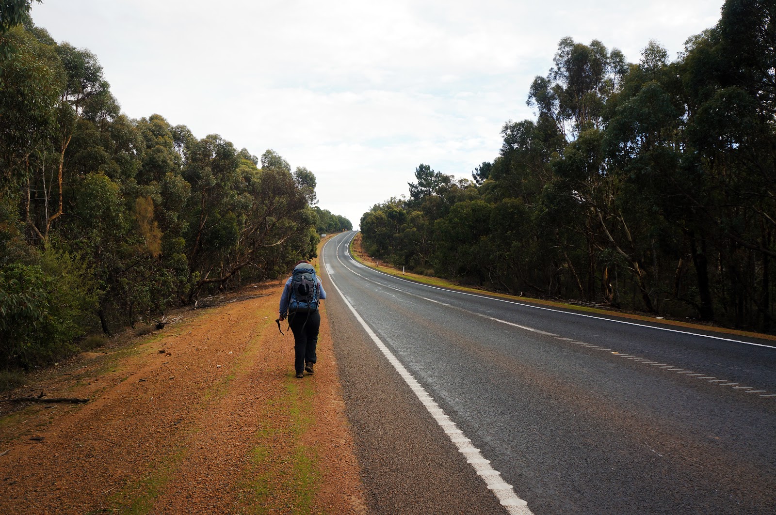
Having driven down Albany Hwy many times over the last few years, I've always pointed out the Albany Hwy crossing to Alissa as we've approached North Bannister. Actually crossing the highway was like crossing a major mental threshold. Walking the Bibbulmun Track in sections, Albany Hwy has often been an imaginary line separating the everyday adventures of walking through the Darling Scarp close to Perth from the rest of the track. By crossing over to the other side, we were finally linking the sections from Kalamunda to North Bannister that we'd largely done as day walks in 2015 with the overnights and multi-day adventures we'd completed further down the track.

Immediately after crossing Albany Hwy, the Bibbulmun heads down a vehicle track through some lovely Wandoo woodlands.

This did not last long however; after a few hundred metres, Alissa and I were walking along a property boundary with some fairly ordinary Jarrah forest to our right and an ugly Blue Gum plantation to our left. This route was obviously chosen as a matter of expediency, however I do think the illusion of wilderness could have been easily maintained if the track went through the middle of the Jarrah rather than along the boundary. Nevertheless, it was nice to see the first wildflowers of the season beginning to appear along the track - even if dull grey and khaki were the predominant colours.

A large slab of granite to the right of the track offered a break from the less than inspiring views, and served as a bit of a precursor to the granite-dominated walking nearer to Boonerring Hill.
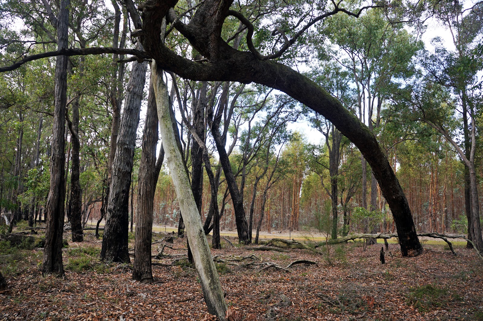
One of the more intriguing sights along the Jarrah forest/Blue Gum plantation stretch of the walk was a tree that had somehow grown at an impossibly bent angle, and now stood precariously with much of its weight leaning towards the track. Although supported by a long pole/dead tree that seems to have been purposely put in place, I can imagine a very strong storm being enough to push this tree over.

Reaching the corner of the Blue Gum plantation, the track passes a boot cleaning station before rising up towards Boonerring Hill along lovely single file walking track.

Although fairly relentless, a granite outcrop along the ascent provides a good break. Exploring the area while waiting for Alissa to catch up, I noted an unmarked but relatively formed trail running off on the other side of the outcrop, and made me wonder where it could be going.

The Bibbulmun eventually levels out and traverses a relatively gentle saddle. The summit of Boonerring Hill could be seen quite clearly towering overhead.

Continuing on, the terrain became increasingly filled with a jumble of granite boulders highly reminiscent of the excellent walking across Mt Cuthbert, Mt Vincent, Sullivan Rock and Mt Cooke. Those are some of my favourite sections of the Bibbulmun, so I was excited by the prospect of similar walking along this stretch of the track.

Following the Bibbulmun's strange tradition of not marking significant side trips like Rocky Pool and the 'secret' summit trail behind Woolbales while giving something like the old well near Chadoora its own sign, the track to the summit of Boonerring Hill is oddly inconspicuous and is easily passed if you are not paying attention. This is particularly bizarre given that the return journey up Boonerring Hill is actually counted towards the day's kilometres in the old chunky Northern Half guidebook! Nevertheless, the turn off can be easily identified if you know what you are looking for - there is a small cleared area at a point where the trail bends sharply away from Boonerring Hill, and there is a tree with Waugals pointing in both directions as pictured above. From the clearing, a side trail should be visible - this is the route to the summit.

Although relatively easy to follow, the summit trail is quite overgrown and seemed to be lined with all of the scratchiest understorey plants that the Jarrah forest can offer! Thankfully, the ascent is only brief and before long Alissa and I broke out through the scrub to the edge of the hill's granite dome. A distinctively cracked section of granite greeted us, appearing like something between cobblestones and the scree fields of Toolbrunup Peak in the Stirling Range. While making our way up the hill, Alissa and I met two End to Enders enjoying the views after many weeks spent deep in the Jarrah forests.

Once at the cracked section of granite, the walk to the summit is an easy task, and is marked by a fairly obvious cairn.

The 360° views from the summit are quite spectacular, and it feels like quite a large reward for relatively little effort compared to the somewhat interrupted views from the summits of Mt Vincent, Cuthbert and Cooke - the latter of which can actually be seen from Boonerring Hill's summit. Incidentally, the more modestly named Boonerring Hill is actually taller than Mt Vincent and Cuthbert, and one has to wonder why there is such a discrepancy in nomenclature. Whatever the case, its less convenient location and more modest name gives Boonerring Hill a greater sense of solitude and quiet - even if the Blue Gum plantation and a conspicuous gold mine nearby shatters the illusion of true wilderness somewhat.

Heading back down the corridor of scratchiness and back onto the Bibbulmun Track proper, the track heads through a section of lovely Wandoo across the top of the hill. The area reminded me of other great stretches of walking through Wandoo like the Numbat Track in Paruna Wildlife Sanctuary and the section of the Bibbulmun between Ball Creek and Waalegh.

The track then descends steeply down the hill towards the broad valley between Boonerring Hill and the White Horse Hills.

After the strenuous and exciting walking from the ascent of Boonerring Hill onwards, the walking in the valley was easy but less remarkable, as the Bibbulmun utilised an old vehicle track to take us through some fairly ordinary Jarrah forest.

Along the old track, the Bibbulmun Track guidebook pointed to Boonerring Spring as an important landmark along the road. Referred to as a 'permanent waterhole', it was alarming to find it was completely dry - not much of a waterhole at all!

The vehicle track walking goes on for just over two kilometres from start to finish. While walking along unsealed roads is not my favourite, the relatively dense forest prevented this from being boring, and Alissa and I agreed that we were enjoying the day much more than we had enjoyed most of the Pingerup Plains section of the track in April (especially that particularly horrible stretch along Marron Rd).

After 2.1 kilometres of vehicle track walking, the Bibbulmun once again runs as a single file walking track. The turn off is not overly well marked by Waugals, however hikers have taken it upon themselves to make it clearer by placing a cairn near the turn off as well as branches across the vehicle track.
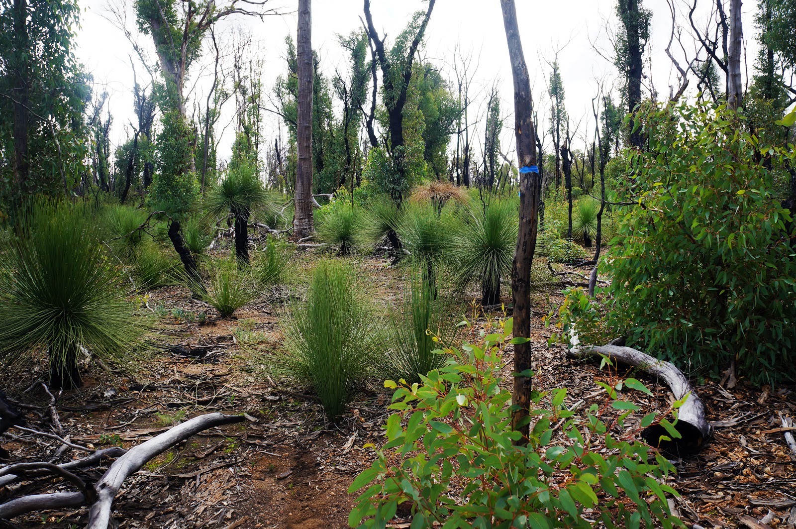
Lack of clarity became something of a theme for the next few kilometres as the track passed through an area badly burnt by bushfires in late 2015. The track through much of this section was vague and indistinct, however maintenance workers or other hikers had tied blue flag tape to help guide the way. Once we knew to look out for the flag tape, the area was relatively easy to navigate, and in time I would imagine a clear bush pad will form.


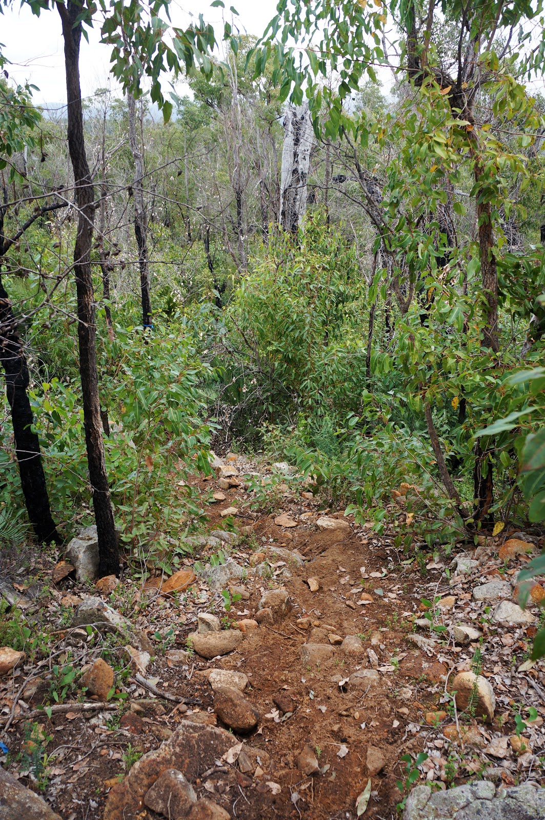
After coming across a burnt out and no longer usable boot cleaning station - and feebly attempting to clean our boots against a burnt out Grass Tree only to have it crumble beneath our feet - the track rises again as it heads up Kimberling Hill.

The climb was gentler than the ascent of Boonerring Hill, with several flat ridges lined with Wandoo. Although the trees had clearly been burnt by the same bushfires we had encountered in the valley below, it is incredible how much less burnt smooth barked Eucalypts like Wandoo and Karri look after a fire. By comparison, a burnt Jarrah tree seems to take many, many more years to recover in appearance - if they recover at all!

The walk up Kimberling Hill reaches its highest point as it ascends a granite dome.

The views from the top are somewhat obscured by the surrounding forest, with the old chunky guidebook suggesting that there are good views north and north-east 50-100 metres off track. To me this seems like a bit of a cruel tease - why not just have the track go 50-100 metres north to take us to these good views rather than encouraging us to go off track and potentially cause damage to the surrounding forests?
From the granite dome, the track heads downhill. Knowing that the hut and campsite were down the hill, Alissa and I knew that we were now on the home stretch.

With growing anticipation, Alissa and I were looking for the hut at every bend of the track. We eventually spotted the toilet to the left of where we were walking, and after crossing an old vehicle track we were finally at White Horse Hills campsite. The hut at White Horse Hills is one of the smaller 'Standard'-style shelters more common to the northern extreme of the track. These smaller huts feature bunks and a table in the middle of the space and have quite an aesthetically pleasing appearance even if they are less practical than the other design styles. We were greeted at the hut by a lone hiker completing a sectional End to End in preparation for her thru-hike attempt later this year, with a trio of ladies doing the same three day stretch as we were and a solo male hiker walking out and back from Albany Hwy joining us later in the afternoon.

Having found Powerline Rd to Wearne Rd to be fairly dull and knowing that the first bit of walking after Albany Hwy would be running along a Blue Gum plantation, I wasn't sure to expect of this day on the track. Thankfully, the walk to White Horse Hills was very enjoyable and scenic, with the granite dome of Boonerring Hill have many of the qualities that make the Monadnocks and Mt Cooke such highlights of the Bibbulmun's Northern Half. Having been somewhat disappointed by the uneven nature of the Northcliffe to Walpole stretch of the track, this day served as a great reminder of why I actually consider the Darling Scarp section the third most spectacular part of the Bibbulmun, behind Walpole to Denmark and Donnelly River Village to Pemberton. A highly recommended day of walking.


this section of the track is my favourite and reading this I want to go back out now. x
ReplyDeleteIt was so good I was surprised - people don't talk about this section that much so I didn't know what to expect!
Delete