

An idyllic loop walk in the Karri forest, the Gloucester Route provides a pleasant amble through Gloucester National Park. Starting at the famous Gloucester Tree, the well marked trail initially runs concurrently with the Bibbulmun Track before branching off to explore a beautiful stand of Karris. A very pleasant and peaceful walk, this is a perfect walk for fans of forest walking.
Distance: 10 km ('tadpole' loop)
Gradient: Alternates between some very steep ascents and descents with gentle sections.
Quality of Path: A mix of purpose built walk trail and repurposed vehicle tracks
Quality of Signage: Generally well signed, with a black coloured Karri tree marker unique to the trail
Experience Required: Some Bushwalking Experience Recommended
Time: 2-3 Hours
Steps: Some minor steps
Best Time to Visit: Autumn-Spring, though Spring would be the most spectacular time to visit
Best Time to Visit: Autumn-Spring, though Spring would be the most spectacular time to visit
Entry Fee: Yes. National Park fees apply
Getting There: The trail starts at the Gloucester Tree. From the main street of Pemberton on Vasse Hwy, take Ellis, Robinson or Widdeson Sts, turn left onto Kennedy St and continue on Kennedy as it becomes Burma Rd. The turn off to the Gloucester Tree is clearly signed. 
Over the last few months, Alissa and I have been working up to the completion of the Bibbulmun Track, and the weekend of 9-10th September was earmarked as the final two days of our sectional End to End. Unfortunately, our best laid plans were scuttled by illness, as Alissa had become quite sick in the lead up to the weekend. Having a hotel booking in Bridgetown that we couldn't get out of, Alissa and I had to make a decision about what to do to salvage the weekend. Although Alissa suggested completing the two day section without her, it was important to me that we complete the track together. After some thought, we came up with an alternate plan - I would complete a day walk in Pemberton and we would then go stay with Alissa's parents in Denmark. Wanting to walk something of a reasonably substantial length, I settled on the Gloucester Route - a 10 kilometre trail that had piqued my interest after seeing write ups by Nature Mondays and the Life of Py.

The trail starts at the famous Gloucester Tree, with the trailhead located just to the right of the tree's day use area. Coincidentally, there is a photograph of me at the age of thirteen standing on top of the Bibbulmun Track trailhead located nearby, and it was during that birthday holiday that I first decided I was going to walk the Bibbulmun Track someday.

Two other walks start from the trailhead - the Dukes Walk (400 metres) and the Karri View Trail (800 metres). All three have distinctive Karri tree markers, with the Gloucester Route featuring black markers along its entire length. This first stretch of track is also shared with the Bibbulmun Track, and was walked by Alissa and I in 2016 when we walked from Warren to Pemberton.

The shorter trail loops branch of the main trail, and are well signed. Walkers will however need to pay attention to the colour of the trail markers as the marker symbol is identical for all trails.

Even at this early point in the walk, the view of the surrounding Karri forest is quite spectacular. The Gloucester Tree is located on conspicuously high ground on one side of a valley, and walkers are able to see across to the other side through the trees. This creates a nice sense of depth to the forest views, with trees seemingly stretching out as far as the eye can see.

The stretch of the walk that runs concurrently with the Bibbulmun Track is an almost continual descent, and I remember it being considerably more difficult when we walked this in the other direction. Upon reaching a road, the Bibbulmun turns right and follows the road downhill, while the Gloucester Route crosses over to the other side.

One other side of the sealed road, the Gloucester Route descends a series of steps to the first of many bridge crossings along the track. At the time of my visit, the stream was little more than a gentle, shallow flow, however I'm sure it gets significantly deeper during heavy rains.

The first bridge was the start of an obvious pattern along this walk - where there was a bridge crossing, there will inevitably be a steep ascent on the other side. While I've done many harder ascents (especially the 'hard day' on the Bibbulmun between Boarding House and Beavis), the stretches of uphill walking definitely got the heart rate up, and I appreciated that the climbs were rewarded with excellent forest views to make it worthwhile.

The walk reaches a trail junction with the sign indicating that the Gloucester Route turns right rather than continuing straight up the hill just to the left of the picture above.

The walking was much of the same beautiful forest walking as seen earlier along the walk. While some could argue that it is rather samey, the sheer grandeur of the Karri allows it to remain much more engaging than the thin and scrappy Jarrah forest common to the Northern Half of the Bibbulmun Track and Darling Scarp area in general.

After rising slightly, the trail once again descends to cross the second bridge crossing, with the stream flow being even less than the previous crossing. To the right of the bridge, it was fairly obvious that bikes have been using the Gloucester Route, and that the wooden bollard blocking the bridge had done little to prevent them from access.

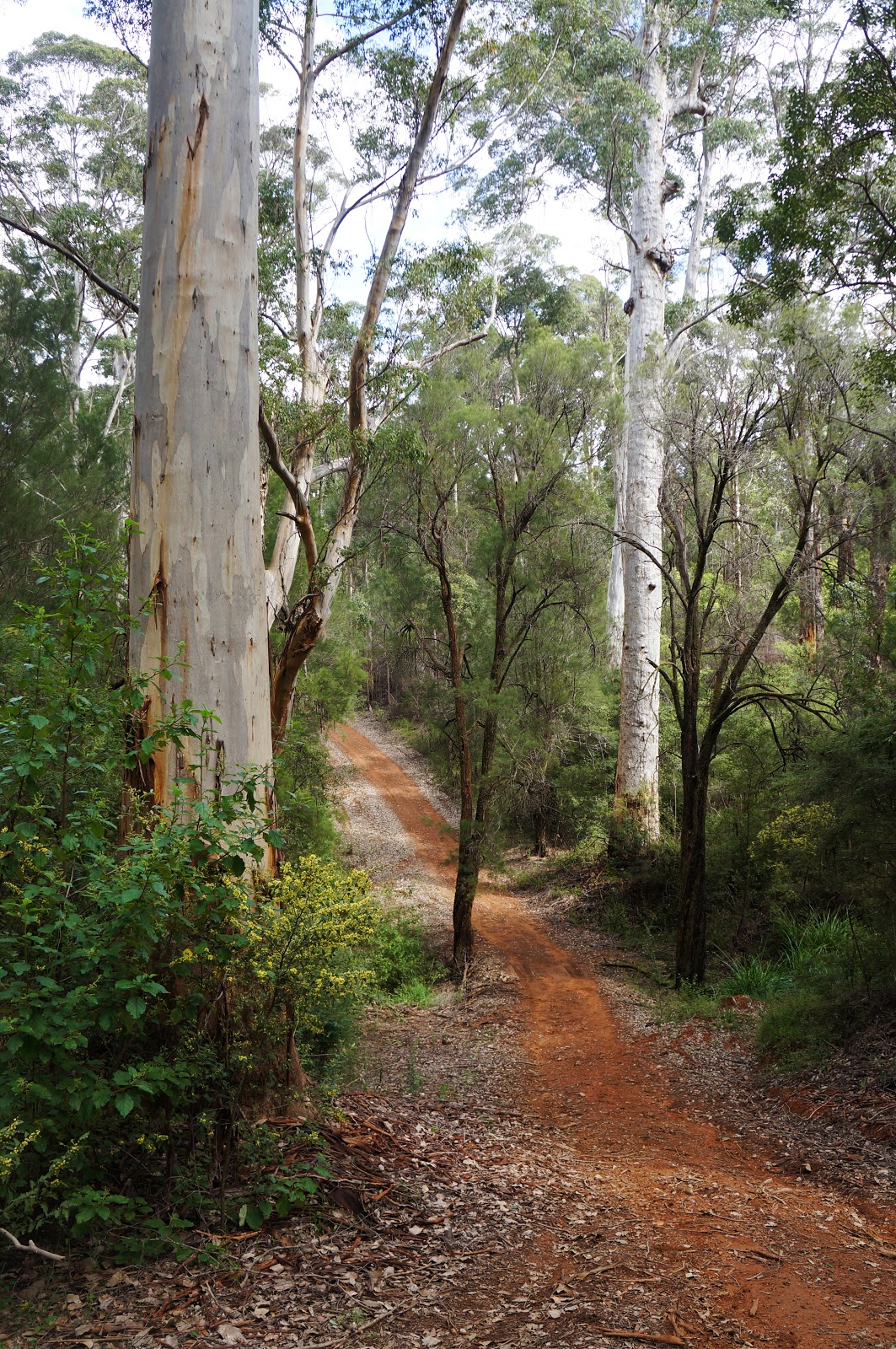
The second bridge was inevitably followed by another steep ascent with lovely valley views across the Karri forest before descending yet again to cross the third bridge of the walk. At some point, the trail had transitioned from a single file walking trail to what seemed like it had once been a vehicle track. I'm on record as being not a fan of most vehicle track walking, however I generally make an exception for Karri forests as the more open width helps prevent the often dense understorey from becoming claustrophobic.

Although the shallowest of the first three crossings, the creek flow was considerably faster and more audible, and it was easily my favourite of the three.

Standing on the bridge and looking downstream, I could see the water flowing down a gentle waterfall as it made its way to the valley below.

Continuing along, the walking is again more of the same beautiful Karri forest with little in the way of landmarks. It was at this point that I realised that while I had my PLB on me (a bit of overkill for a well marked Class 3 walk), I had foolishly left my phone in the car. While I had no idea how far I had travelled and couldn't check the time for progress indication, I didn't much mind as I was finding the walk to be very enjoyable even if it was much of the same. I would usually describe enjoyable but samey forest walking as 'pleasant', but the word that kept coming to mind along this walk was 'idyllic' given the peaceful quiet that the forest offered.

Continuing along the trail, I noted an obvious transition to thinner regrowth Karri trees, punctuated by the odd old giant that had been spared by previous logging operations and survived the ravages of bushfires.

As I continued along the trail, I had become so lost in my own thoughts that I hadn't initially realised that the walk had transitioned away from Karri forest and I had entered an area dominated by a mix of Jarrah and Marri. It was only when I saw the tell-tale blackened barks of a recent control burn that I cottoned on to the change. As you'd expect, this was the least engaging part of the walk, however it was not altogether terrible either - I've walked through much more depressingly burnt sections of the Bibbulmun Track for instance.

The forest briefly transitions back to Karri forest as it reaches a broad but shallow flats. Rather than raised bridges, a series of duck boards allow walkers to keep their feet dry as they make their way to the other side.

Beyond the flats, the trail rises slightly through more controlled burnt forest as it reaches a junction in the trails. An interesting aspect of walk trails in the Pemberton area is that the bush walks sometime lead to surprising landmarks. The Warren River Loop has a side trail that leads to the Pemberton Wine Centre, and there is a trail that links Beedelup Falls to Karri Valley Resort. On the Gloucester Route, a side trail leads to the famous Lavender and Berry Farm - a popular mainstay of the Pemberton region that I've visited countless times. While I did not visit the Berry Farm on this occasion, you can read a more thorough write up of their food on my old food blog the Ministry of Gluttony - I highly recommend their incredible Berry Pancakes.
Beyond the Berry Farm side trail, the forest transitions away from the burnt Jarrah and Marri to areas once again dominated by Karri forest. While quite a bit of the walk is along vehicle tracks that have now become reclaimed by the forest and are more suitable for walkers, the trail along this section turns onto a stretch of road that is quite clearly still used by motor vehicles. This section of road is very short however; after crossing a culvert, the Gloucester Route turns back onto trail that is used by walkers only.

Cutting across the side of the hill, this section of trail definitely gave me the impression that we were heading back to the Gloucester Tree, and I began wondering how the trail would complete its loop.

As I continued along, I came upon a sign that looked very familiar. It was the exact same sign I had seen when I took a right turn earlier along the walk, with the branch leaning against it being an obvious telltale sign. This ended the walk's loop, and meant that the last two kilometres of the walk would be a return journey.

That meant having to walk back up the steep hill to the Gloucester Tree, and it immediately gave me flashbacks to our Northcliffe to Pemberton Walk and the feeling of anticipation we felt as we were getting close to town. As I was walking, I saw a tree I remembered photographing last time, and I tried to replicate the same scene in the shot above.

From there, it was a short walk back to the picnic area underneath the Gloucester Tree - the famous climbing tree that allows visitors to reach a lookout high above the forest canopy. If you've never climbed the tree before, this would be the perfect time to give it a go. Although it looks scary and seems surprisingly unsafe given Western Australia's general aversion to anything remotely dangerous, it should provide some comfort to know that no one has ever died climbing the tree, and in my opinion it is easier than the taller Dave Evans Bicentennial Tree and the shorter but steeper Diamond Tree. Having climbed the Gloucester Tree at least five times before and not wanting to keep Alissa waiting, I decided to give it a miss this time and call it a day.
The Gloucester Route is a pretty simple walk really, being a return loop that largely passes through relatively samey Karri forest with a short section in Jarrah. If you're looking for a walk with mountains or gorges then you may be disappointed, however if you love the grandeur of Karri forest and want something meditatively peaceful, then the Gloucester Route is a very enjoyable walk. While I would rate it behind the Warren River Loop as far as Pemberton Karri forest walks go, this is a beautifully idyllic trail that will definitely please fans of forest walking.


0 comments:
Post a Comment