

A stunning coastal walk in New South Wales, the 3.7 kilometre Cape Byron Walking Track takes visitors to the easternmost point of the Australian Mainland. Passing the stunning Byron, Wategos and Little Wategos Beaches, the trail's main focal point is the Cape Byron Lighthouse and the rugged coastline of the cape. A short but excellent coastal walk that is well worth checking out when visiting Byron Bay
Distance: 3.7 km (loop)
Gradient: Alternates between generally level terrain and sections of steep steps ascending and descending
Quality of Path: Mostly sealed and all well maintained
Quality of Signage: Clear and easy to follow trailhead with directional signage at key junctions with in depth trail information including maps.
Experience Required: No Bushwalking Experience Required
Time: 1-2 Hours
Steps: Several steps leading down to the loop from the car park.
Best Time to Visit: All year.
Best Time to Visit: All year.
Entry Fee: None, but expect to pay through the roof for extremely expensive parking!
Getting There: The trail starts at the main car park on Lighthouse Rd near the Captain Cook Lookout approximately 260 metres after Tallow Beach Rd. 
Ah, New South Wales. In spite of having spent far more time in Melbourne than I have in Sydney, the fact New South Wales can be visited from Sydney, Canberra and Brisbane/the Gold Coast has made it a state I've enjoyed exploring given that different parts of the state can be conveniently reached a short drive from a major city. On our second weekend living on the Gold Coast, Alissa, Simon and I headed south across the border to check out the beach town of Byron Bay. Famous for being something of an east coast Margaret River (sans world class wineries) and the home of Chris Hemsworth, the town's main draw for me was a chance to walk the Cape Byron Walking Track - especially since it would take us to the easternmost point of the Australian mainland.

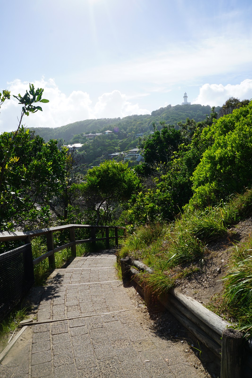
Starting from the main car park on Lighthouse Rd, the trail starts by heading along wooden boardwalks perched above the coastal ridge. The walkway provides excellent views of the large Byron Beach, with the mountains of the hinterland visible in the distance.

Leaving the boardwalk behind, the trail turns onto a dual use path. The vast majority of the trail runs along sealed paths, which makes it less of a wild bushwalk than I would like but makes it a more accessible option for casual tourists. As with most walking experiences I've had in New South Wales, the National Parks and Wildlife Service have done an excellent job providing clear and consistent trail markings along the way.

Continuing along, we veered off the trail to check out the Pass and Fisherman's Lookout. A small island of rock connected to the coast by the sandy beach, the Fisherman's Lookout provides excellent views of the surrounding area, which is a very popular surfing spot.

Picking up the trail again on the other side of the Pass car park, Simon, Alissa and I decided to take a small detour to check out Palm Valley.

A 200 metre loop track in its own right, the Palm Valley Loop provides an easy amble through a section of palm-filled forest. This was a nice change of scenery that was worth the short detour before returning to the coast views of the Cape Byron Track.

Back on the track, the walk rises up to run along the cliff tops. This definitely brought back memories of our thru-hike of the Cape to Cape Track in Margaret River, in particular the lookout area just south of Gracetown.

In the distance, Alissa, Simon and I spotted a small island off the coast. Known as Julian Rocks, these form an important marine reserve within Cape Byron Marine Park. The three of us would be visiting Julian Rocks later in the day for a snorkel expedition and the views of the rocks definitely filled us with excitement and anticipation.


With the trail continuing high along the coastal cliffs, the Cape Byron Track continued to providing surprisingly wild and stunning coastal scenery as we made our way to Wategos Beach.
As we descended towards the beach, the illusion of wilderness was shattered by the appearances of beachside houses, however we were also rewarded with our first views of the Cape Byron Lighthouse high on the hill.

The track passes by Rae's on Wategos - a boutique hotel that looks like an art deco mansion from an old Hollywood film. The vibe is best summed up as 'bourgeois hippy', which could easily apply to Byron Bay in general.

Although Alissa and I are not really beach people, the hot weather made the inviting Wategos Beach very tempting. With our towels left in the car and with plans to swim after the walk, we continued onwards to the next section of the trail.

After passing an area of new boardwalk that was being constructed, we continued up along the path as it made its way across the coastal ridge.

Looking back, the coastal ridge provided excellent views of Wategos Beach and the actual bay of Byron Bay.

Just before a steep series of steps, a short side trail leads to Little Wategos Beach and a lookout point. Although this point is not the most easterly point of the mainland, it is a beautiful section of coast that is well worth the short detour.

Looking to our right, Alissa, Simon and I could see the actual most easterly point as we made our way to the lookout point.

From the lookout, walkers are provided with lovely views of the tip of Cape Byron.

Back onto the main trail, the three of us had the 'pleasure' of continuing up a long and continuous series of steps to the most easterly point.

Considering how much more beautiful the tip of Cape Byron is, the most easterly point is actually a bit of an anti-climax. There is nothing overly significant about the spot other than the mere fact it is the most easterly point, and looks far less impressive than photos of its cardinal point brethren Cape York, South Point and Steep Point suggest.

Regardless, the views from the easternmost point of the tip of Cape Byron are quite excellent and make up for the anti-climax of the point itself.

After the easternmost point, the trail continues along the clifftops as it makes it way to Cape Byron Lighthouse.

As we approached the lighthouse, I definitely had flashbacks to the lighthouses at the start and end of the Cape to Cape Track in Margaret River and on Rottnest Island off the Western Australian Coast.

Although less grand than Cape Leeuwin's massive lighthouse, Cape Byron's is nevertheless an architecturally beautiful building and a major highlight of the trail.

From the lighthouse, it is a short walk to a the Cape Byron Lighthouse Cafe and a National Parks and Wildlife office. Given the hot and sticky weather, the three of us stopped into the cafe for a quick ice cream and a bit of shopping at the National Parks and Wildlife store. I have to say that NSW's Parks and Wildlife are pretty got at monetising their attractions, and I was glad to pick up a copy of a book released to celebrate 50 years of the National Parks and Wildlife Service.

After our ice cream and retail therapy, we continued on the trail as it ran alongside the lighthouse access road. Although walking along a road is less than ideal, the view of Tallow Beach below were nevertheless an enjoyable aspect of this section of the walk.

As the trail branches off away from the road, it heads along the spine of the coastal ridge. An interesting sight along this stretch of track is a hang gliding launch platform.

Simon and I stopped for a moment to take in the views, while Alissa was keen to push on as she was pretty convinced we'd catch up to her.

The final stretch of the Cape Byron Walking Track heads through a sheltered stretch of forest, and is the only part of the trail that feels like a proper bushwalk due to the lack of paved paths.

The forested section was shorter than we had expected, and it wasn't long before we were crossing the road and back at the car park at the start of the trail.
Post-Script

Later in the afternoon, Simon, Alissa and I went out on a boat to Julian Rocks for a snorkelling tour. Due to its location between the hot tropics and the colder Southern Ocean, Julian Rocks is a somewhat unique location as it is home to species found on the Great Barrier Reef as well as species found further south in the Southern Ocean. With the promise of seeing sea turtles we had to check it out.


We were not disappointed by the sea turtles, and we were able to get pretty close to them in the last few minutes before the end of our expedition!

This was a major early highlight of our time in the Gold Coast/North Coast regions and one that I would thoroughly recommend to those visiting Byron Bay. It definitely made Alissa and I want to go buy some snorkelling gear and do more of this when we get back to Western Australia.


0 comments:
Post a Comment